2020年中南半岛缅甸30m土地覆盖产品数据集
收藏地球大数据科学工程2024-04-26 收录
下载链接:
https://data.casearth.cn/sdo/detail/636e17eb819aec5df66b51da
下载链接
链接失效反馈官方服务:
资源简介:
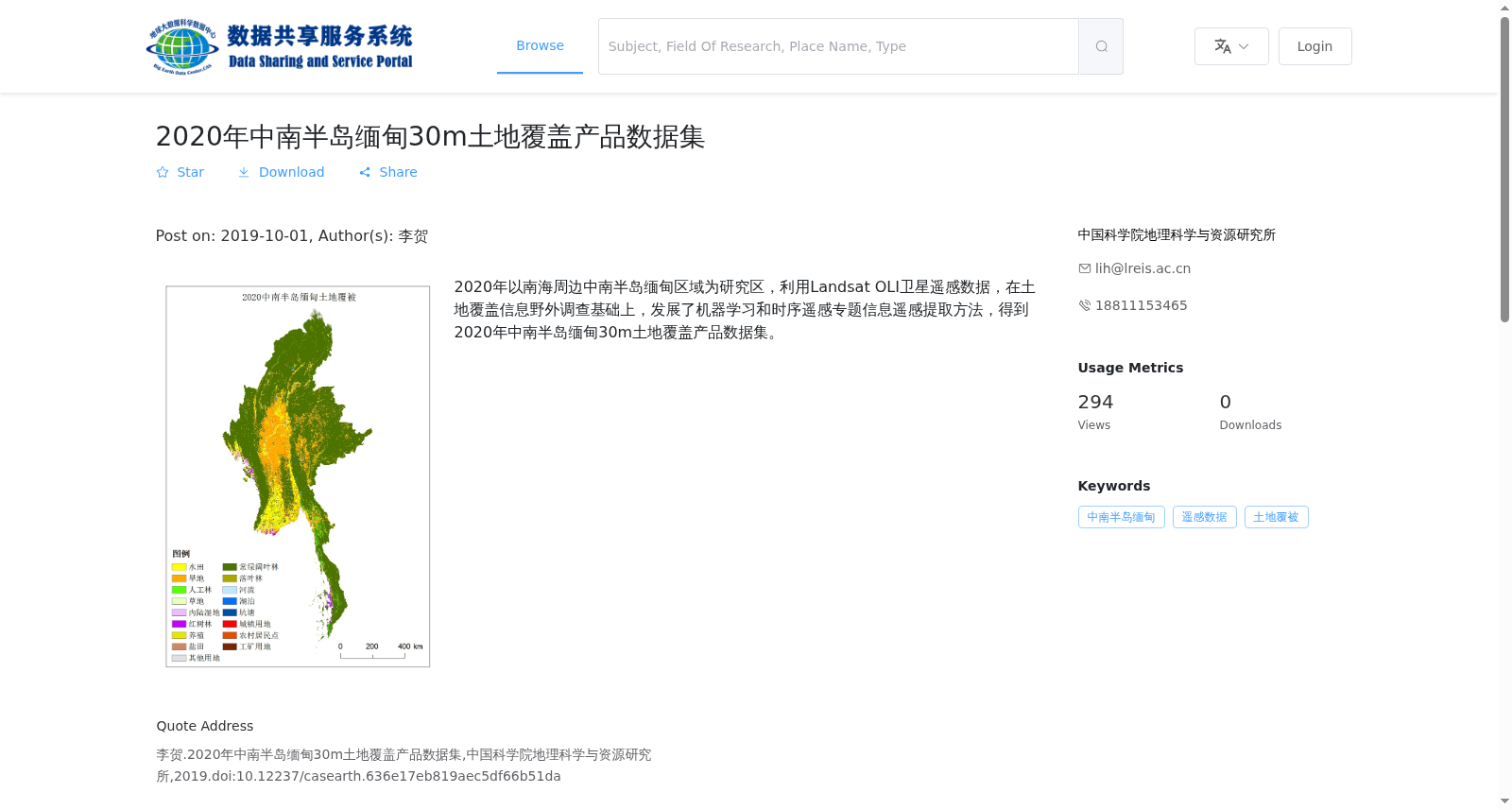
2020年以南海周边中南半岛缅甸区域为研究区,利用Landsat OLI卫星遥感数据,在土地覆盖信息野外调查基础上,发展了机器学习和时序遥感专题信息遥感提取方法,得到2020年中南半岛缅甸30m土地覆盖产品数据集。
In 2020, taking the Myanmar region of the Indochinese Peninsula adjacent to the South China Sea as the study area, using Landsat OLI satellite remote sensing data, and based on field surveys of land cover information, we developed machine learning and time-series remote sensing based thematic information extraction methods, and produced the 30-meter resolution land cover product dataset for Myanmar on the Indochinese Peninsula in 2020.
提供机构:
中国科学院地理科学与资源研究所
搜集汇总
数据集介绍
背景与挑战
背景概述
该数据集是2020年中南半岛缅甸区域的30米空间分辨率土地覆盖产品,基于Landsat OLI卫星遥感数据,结合野外调查和机器学习方法生成,以TIFF栅格格式提供,包含5个文件,总容量866 MB,适用于土地覆盖监测和分析。
以上内容由遇见数据集搜集并总结生成


