1987-2020年海南岛30m红树林变化数据集
收藏地球大数据科学工程2024-04-26 收录
下载链接:
https://data.casearth.cn/sdo/detail/6396cf6c819aec7aa363a68f
下载链接
链接失效反馈官方服务:
资源简介:
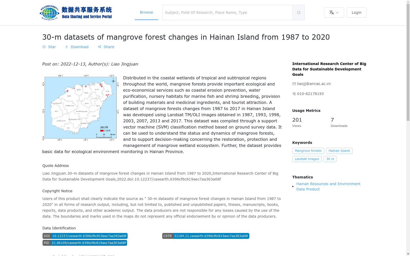
红树林分布在热带–亚热带地区的海岸带湿地,具有重要的生态及生态经济服务价值。本产品利用1987年、1993年、1998年、2003年、2007年、2013年、2017年共计7期Landsat TM/OLI数据,采用支持向量机分类方法,并结合野外调查资料,获取了1987–2017年海南岛红树林变化数据集。本数据集可用于红树林时空变化分析,以及红树林湿地生态系统恢复、保护和管理的决策支持,为海南省生态环境监管提供基础数据支持。
Mangroves are distributed in coastal wetlands of tropical and subtropical regions, and hold significant ecological and eco-economic service values. This dataset employs seven scenes of Landsat TM/OLI imagery collected in 1987, 1993, 1998, 2003, 2007, 2013 and 2017, adopts the support vector machine (SVM) classification method, and integrates field survey data to develop the mangrove change dataset of Hainan Island spanning from 1987 to 2017. This dataset can be utilized for spatiotemporal change analysis of mangroves, provides decision-making support for the restoration, protection and management of mangrove wetland ecosystems, and supplies basic data support for the ecological environment supervision of Hainan Province.
提供机构:
可持续发展大数据国际研究中心
搜集汇总
数据集介绍
背景与挑战
背景概述
该数据集提供1987-2020年海南岛30米分辨率红树林变化信息,基于Landsat影像和SVM分类方法生成,时间跨度为33年,时间分辨率5-7年,为红树林生态系统研究和管理提供重要基础数据。
以上内容由遇见数据集搜集并总结生成


