2000-2010年中国生态系统质量数据
收藏地球大数据科学工程2024-03-04 收录
下载链接:
https://data.casearth.cn/sdo/detail/653f5401819aec161b3b4751
下载链接
链接失效反馈官方服务:
资源简介:
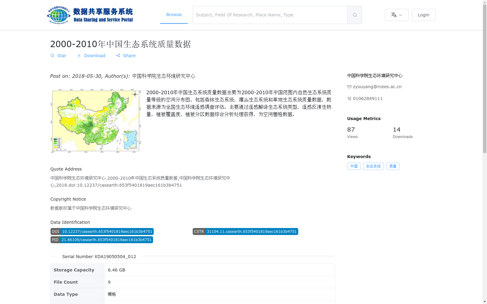
2000-2010年中国生态系统质量数据主要为2000-2010年中国范围内自然生态系统质量等级的空间分布图,包括森林生态系统、灌丛生态系统和草地生态系统质量数据,数据来源为全国生态环境遥感调查评估。主要通过遥感解译生态系统类型、遥感反演生物量、植被覆盖度、植被分区数据综合分析处理获得,为空间栅格数据。
The China Ecosystem Quality Dataset (2000–2010) mainly comprises spatial distribution maps of natural ecosystem quality grades across China from 2000 to 2010, covering quality data of forest, shrubland, and grassland ecosystems. The dataset is sourced from the national ecological environment remote sensing survey and assessment. It was generated via comprehensive analytical processing of multiple datasets, including ecosystem types interpreted through remote sensing, biomass retrieved by remote sensing, vegetation coverage, and vegetation regionalization data, and is stored as spatial raster data.
提供机构:
中国科学院生态环境研究中心
搜集汇总
数据集介绍
背景与挑战
背景概述
该数据集提供了2000-2010年中国范围内自然生态系统质量等级的空间分布图,涵盖森林、灌丛和草地生态系统,基于全国生态环境遥感调查评估,通过遥感解译和综合分析处理生成。数据为栅格格式(.tif),存储容量6.46 GB,包含9个文件,由中国科学院生态环境研究中心发布,适用于生态系统质量评估和研究。
以上内容由遇见数据集搜集并总结生成


