青藏高原遥感影像及1:100万活动断裂解译图(2015-2022)
收藏国家青藏高原科学数据中心2025-01-09 更新2025-04-05 收录
下载链接:
https://data.tpdc.ac.cn/zh-hans/data/4656a167-e701-44de-bb2e-e2a502e563c8
下载链接
链接失效反馈官方服务:
资源简介:
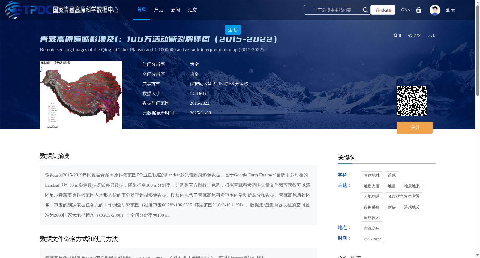
该数据为2015-2019年间覆盖青藏高原科考范围7个卫星轨道的Landsat多光谱遥感影像数据。基于Google Earth Engine平台调用多时相的Landsat卫星 30 m影像数据镶嵌各景数据,降采样至100 m分辨率,并调整直方图校正色调,根据青藏科考范围矢量文件裁剪获得可以清晰显示青藏高原科考范围内地形地貌的高分辨率遥感影像数据。图集内包含了青藏高原科考范围内活动断裂分布数据。青藏高原所处区域,范围的划定依据任务九的工作调查研究范围(经度范围66.28°-106.63°E, 纬度范围21.64°-46.11°N)。数据集/图集内容表征的空间基准为2000国家大地坐标系(CGCS-2000);空间分辨率为100 m。
This dataset comprises Landsat multispectral remote sensing image data covering 7 satellite orbits within the scope of the Qinghai-Tibet Plateau scientific expedition during 2015–2019. Using the Google Earth Engine platform, multi-temporal Landsat 30 m satellite image data were retrieved, mosaicked, downsampled to 100 m spatial resolution, and histogram-adjusted to correct tonal variations. The processed images were then cropped according to the vector file of the Qinghai-Tibet Plateau scientific expedition scope to produce high-resolution remote sensing imagery that clearly displays the topography and landforms within the expedition area. This dataset also includes active fault distribution data within the Qinghai-Tibet Plateau scientific expedition scope. The geographic scope of the Qinghai-Tibet Plateau region is defined based on the investigation and research scope of Task 9, with longitude ranging from 66.28°E to 106.63°E and latitude ranging from 21.64°N to 46.11°N. The spatial reference of the dataset is the 2000 National Geodetic Coordinate System (CGCS-2000), with a spatial resolution of 100 m.
提供机构:
郑文俊,章桂芳,孙鑫
创建时间:
2025-01-04
搜集汇总
数据集介绍
背景与挑战
背景概述
该数据集包含2015-2022年青藏高原的遥感影像和活动断裂解译图,空间分辨率为100米,适用于地质灾害和地震地质研究。数据经过降采样和色调校正处理,覆盖范围经度66.28°-106.63°E,纬度21.64°-46.11°N。
以上内容由遇见数据集搜集并总结生成


