青藏高原SRTM数字高程模型(2000)
收藏国家青藏高原科学数据中心2022-01-11 更新2024-03-07 收录
下载链接:
https://data.tpdc.ac.cn/zh-hans/data/1401a084-49ed-4abf-ae1c-f0b8dc19361a
下载链接
链接失效反馈官方服务:
资源简介:
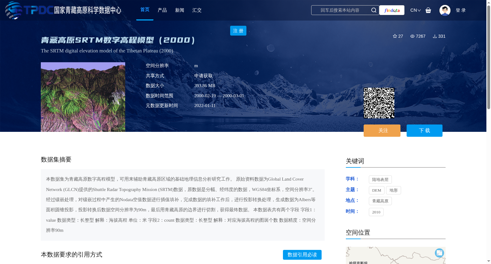
本数据集为青藏高原数字高程模型,可用来辅助青藏高原区域的基础地理信息分析研究工作。
原始资料数据为Global Land Cover Network (GLCN)提供的Shuttle Radar Topography Mission (SRTM)数据,原数据是分幅、经纬度的数据,WGS84坐标系,空间分辨率3″。经过镶嵌处理,对镶嵌过程中产生的Nodata空值数据进行插值填补,完成数据的填补工作后,进行投影转换处理,生成数据为Albers等面积圆锥投影,投影转换后数据空间分辨率为90m,最后用青藏高原的边界进行切割,获得最终数据。
本数据表共有两个字段
字段1:value
数据类型:长整型
解释:海拔高程
单位:米
字段2:count
数据类型:长整型
解释:对应海拔高程的图斑个数
数据精度:空间分辨率90m
This dataset is a digital elevation model (DEM) of the Qinghai-Tibet Plateau, which can be used to assist basic geographic information analysis and research work within the Qinghai-Tibet Plateau region.
The original source data is Shuttle Radar Topography Mission (SRTM) data provided by the Global Land Cover Network (GLCN). The original data is tiled in latitude-longitude coordinate format, adopts the WGS84 coordinate system, and has a spatial resolution of 3 arc-seconds. Mosaic processing was first performed, and Nodata null values generated during the mosaicking process were filled via interpolation. After completing the data filling procedure, projection transformation was conducted to produce data in the Albers equal-area conic projection. The spatial resolution of the data after projection transformation is 90 meters. Finally, the data was clipped using the boundary of the Qinghai-Tibet Plateau to obtain the final dataset.
This dataset contains two fields:
1. Field 1: value
Data type: Long integer
Explanation: Elevation height
Unit: Meter
2. Field 2: count
Data type: Long integer
Explanation: Number of patches corresponding to the given elevation height
Data Accuracy: Spatial resolution of 90 meters
提供机构:
Global Land Cover Network
创建时间:
2018-07-20
搜集汇总
数据集介绍
背景与挑战
背景概述
该数据集是2000年青藏高原SRTM数字高程模型,空间分辨率90米,采用Albers等面积圆锥投影,包含海拔高程和图斑个数信息,适用于基础地理信息分析研究。
以上内容由遇见数据集搜集并总结生成


