2000-2020年极地边缘区高分辨率(10~30m)冰面融水数据集
收藏地球大数据科学工程2024-04-26 收录
下载链接:
https://data.casearth.cn/sdo/detail/6253cddc819aec49731a4bb3
下载链接
链接失效反馈官方服务:
资源简介:
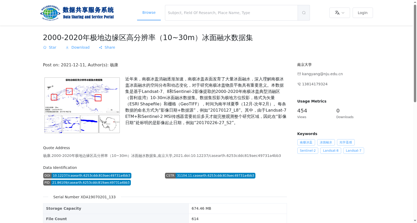
近年来,南极冰盖消融逐渐加速,南极冰盖表面发育了大量冰面融水,深入理解南极冰盖冰面融水的空间分布和动态变化,对于研究南极冰盖物质平衡具有重要意义。本数据集是基于Landsat-7、8和Sentinel-2影像提取的2000-2020年南极冰盖典型消融区(普利兹湾)10-30m冰面融水数据集。数据集投影为极地方位投影,格式为矢量(ESRI Shapefile)和栅格(GeoTIFF),时间为南半球夏季(12月-次年2月)。每条数据的命名方式为“影像日期+数据源”,例如“20170127_L8”。其中,由于Landsat-7 ETM+和Sentinel-2 MSI传感器需要前后多天才能完整观测整个研究区域,因此在“影像日期”处标明的是影像起止日期,例如“20170226-27_S2”。
In recent years, the ablation of the Antarctic Ice Sheet has gradually accelerated, and extensive surface meltwater has developed on its surface. In-depth understanding of the spatial distribution and dynamic changes of surface meltwater on the Antarctic Ice Sheet is of great significance for researching the mass balance of the Antarctic Ice Sheet. This dataset is a 10–30 m resolution surface meltwater dataset for typical ablation zones (Prydz Bay) of the Antarctic Ice Sheet from 2000 to 2020, extracted based on Landsat-7, 8 and Sentinel-2 imagery. The dataset uses polar azimuthal projection, and is provided in vector (ESRI Shapefile) and raster (GeoTIFF) formats, covering the Southern Hemisphere summer (December to February of the following year). The naming convention for each data file is "image date + data source", for example, "20170127_L8". Notably, since the Landsat-7 ETM+ and Sentinel-2 MSI sensors require multiple days to fully observe the entire study area, the "image date" field indicates the start and end dates of the image acquisition, such as "20170226-27_S2".
提供机构:
南京大学
搜集汇总
数据集介绍
背景与挑战
背景概述
该数据集是基于Landsat-7、8和Sentinel-2卫星影像,提取的2000-2020年南极冰盖典型消融区(普利兹湾)高分辨率(10-30米)冰面融水数据,覆盖南半球夏季时段。数据以矢量和栅格格式提供,旨在支持南极冰盖物质平衡研究,通过分析冰面融水的空间分布和动态变化,有助于深入理解极地消融过程。
以上内容由遇见数据集搜集并总结生成


