江苏沿海1:10万土地利用数据(1980s)
收藏国家地球系统科学数据中心2018-06-27 更新2024-03-04 收录
下载链接:
https://www.geodata.cn/data/datadetails.html?dataguid=104849786336813&docId=19773
下载链接
链接失效反馈官方服务:
资源简介:
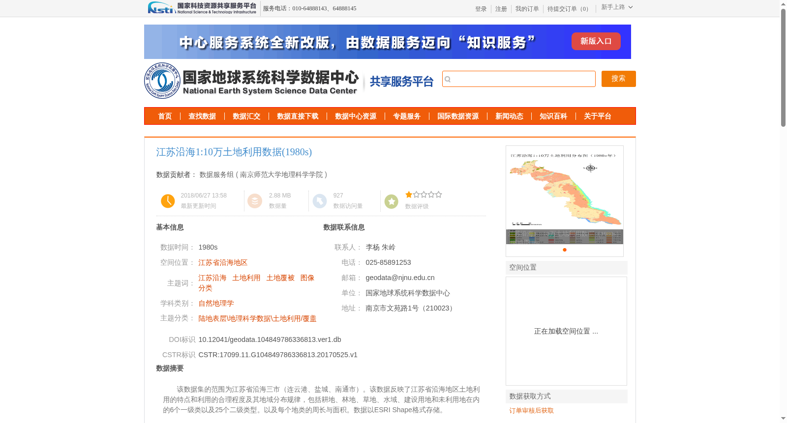
该数据集的范围为江苏省沿海三市(连云港、盐城、南通市)。该数据反映了江苏省沿海地区土地利用的特点和利用的合理程度及其地域分布规律,包括耕地、林地、草地、水域、建设用地和未利用地在内的6个一级类以及25个二级类型。以及每个地类的周长与面积。数据以ESRI Shape格式存储。
This dataset covers three coastal cities in Jiangsu Province: Lianyungang, Yancheng and Nantong. It reflects the characteristics, rational utilization degree and regional distribution patterns of land use in the coastal areas of Jiangsu Province, including 6 first-level land use categories and 25 secondary categories, where the first-level categories cover cultivated land, forest land, grassland, water area, construction land and unused land. The dataset also provides the perimeter and area of each land type, and is stored in ESRI Shapefile format.
提供机构:
南京师范大学地理科学学院
创建时间:
2017-05-25
搜集汇总
数据集介绍
背景与挑战
背景概述
该数据集是江苏省沿海地区(连云港、盐城、南通市)在20世纪80年代的1:10万比例尺土地利用数据,包含耕地、林地、草地、水域、建设用地和未利用地等6个一级类及25个二级类型的详细分类,并提供了每个地类的周长与面积信息。数据基于Landsat TM遥感影像,通过人机交互信息提取和野外验证方法生成,以ESRI Shape格式存储,适用于自然地理学和土地利用研究。
以上内容由遇见数据集搜集并总结生成


