2021年全国尺度Sentinel-1A/B InSAR地表形变年平均形变速率图
收藏地球大数据科学工程2024-04-21 收录
下载链接:
https://data.casearth.cn/sdo/detail/6538852e819aec0f26f4c14b
下载链接
链接失效反馈官方服务:
资源简介:
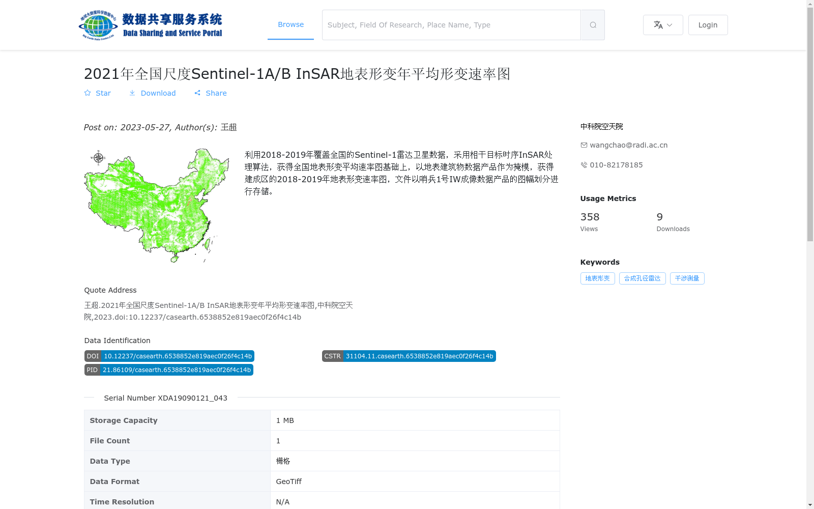
利用2018-2019年覆盖全国的Sentinel-1雷达卫星数据,采用相干目标时序InSAR处理算法,获得全国地表形变平均速率图基础上,以地表建筑物数据产品作为掩模,获得建成区的2018-2019年地表形变速率图,文件以哨兵1号IW成像数据产品的图幅划分进行存储。
Using nationwide Sentinel-1 radar satellite data from 2018 to 2019, the coherent target time-series InSAR processing algorithm was applied to generate the national average surface deformation velocity map. Subsequently, with surface building data products used as a mask, the 2018-2019 surface deformation velocity map of built-up areas was derived. The files are stored according to the tile division scheme of Sentinel-1 IW imaging data products.
提供机构:
中科院空天院
搜集汇总
数据集介绍
背景与挑战
背景概述
该数据集是基于2018-2019年Sentinel-1雷达卫星数据,利用相干目标时序InSAR处理算法生成的全国地表形变年平均速率图,特别以地表建筑物数据为掩模,突出了建成区的形变情况。数据以GeoTiff栅格格式存储,属于卫星观测经时序InSAR处理后的监测产品,适用于地表形变监测和分析。
以上内容由遇见数据集搜集并总结生成


