1961-2013年中国地面降水日值0.5°×0.5°格点数据集
收藏地球大数据科学工程2024-05-06 收录
下载链接:
https://data.casearth.cn/sdo/detail/5c19a5690600cf2a3c557bb2
下载链接
链接失效反馈官方服务:
资源简介:
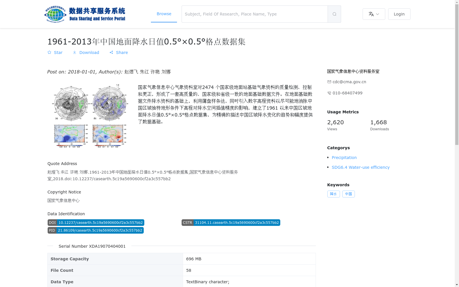
国家气象信息中心气象资料室对2474 个国家级地面站基础气象资料的质量检测、控制和更正,形成了一套高质量的、国家级和省级一致的地面基础数据文件。在地面基础数据文件降水资料的基础上,利用薄盘样条法,同时引入数字高程资料以尽可能地消除中国区域独特地形条件下高程对降水空间插值精度的影响,建立了1961 以来中国区域地面降水日值0.5°×0.5°格点数据集,为精确的描述中国区域降水变化的趋势和幅度提供了数据基础。
Meteorological Data Office, National Meteorological Information Center conducted quality inspection, control and correction on the basic meteorological data from 2474 national ground meteorological stations, thereby establishing a set of high-quality ground basic data files that are consistent across national and provincial levels. Based on the precipitation data from these ground basic data files, using the Thin Plate Spline method and introducing digital elevation data to minimize the impact of elevation on the accuracy of precipitation spatial interpolation under China's unique topographic conditions, a 0.5°×0.5° grid dataset of daily ground precipitation over China since 1961 was developed. This dataset provides a data foundation for accurately describing the trends and magnitudes of precipitation changes across China.
提供机构:
国家气象信息中心资料服务室
搜集汇总
数据集介绍
背景与挑战
背景概述
该数据集是一个1961年至2013年中国区域地面降水日值格点数据,空间分辨率为0.5°×0.5°,基于2474个国家级地面站的高质量观测资料,通过薄盘样条法结合数字高程资料进行空间插值,以消除地形影响,旨在精确描述中国降水变化的趋势和幅度。数据格式为NetCDF,时间分辨率为逐日,存储容量为696 MB,包含58个文件,适用于大气科学研究和气候变化分析。
以上内容由遇见数据集搜集并总结生成


