2018年中南半岛泰国海岸带30m土地利用产品数据集
收藏地球大数据科学工程2024-04-26 收录
下载链接:
https://data.casearth.cn/sdo/detail/5da578a8329b5613607cc952
下载链接
链接失效反馈官方服务:
资源简介:
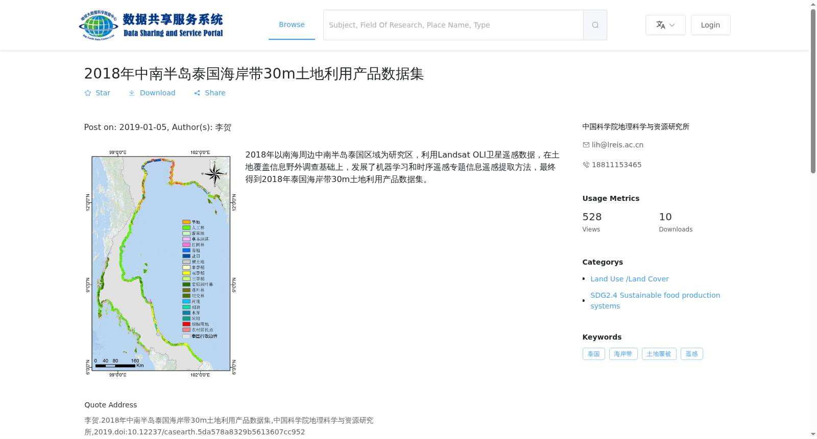
2018年以南海周边中南半岛泰国区域为研究区,利用Landsat OLI卫星遥感数据,在土地覆盖信息野外调查基础上,发展了机器学习和时序遥感专题信息遥感提取方法,最终得到2018年泰国海岸带30m土地利用产品数据集。
In 2018, with the Thai region of the Indochina Peninsula surrounding the South China Sea as the study area, we utilized Landsat OLI satellite remote sensing data, developed machine learning and time-series remote sensing thematic information extraction methods based on field surveys of land cover information, and finally generated the 30-meter land use product dataset of the Thai coastal zone in 2018.
提供机构:
中国科学院地理科学与资源研究所
搜集汇总
数据集介绍
背景与挑战
背景概述
该数据集是2018年针对中南半岛泰国海岸带区域的土地利用产品,空间分辨率为30米,基于Landsat OLI卫星遥感数据,结合野外调查和机器学习方法开发。数据以GeoTiff格式提供,时间分辨率为年,主要用于土地覆被研究,支持可持续发展目标分析。
以上内容由遇见数据集搜集并总结生成


