广东海岸带年平均降水量分布图(1:150万)
收藏南海海洋数据中心2024-03-01 收录
下载链接:
https://data.scsio.ac.cn/metaData-detail/1503943961502732288
下载链接
链接失效反馈官方服务:
资源简介:
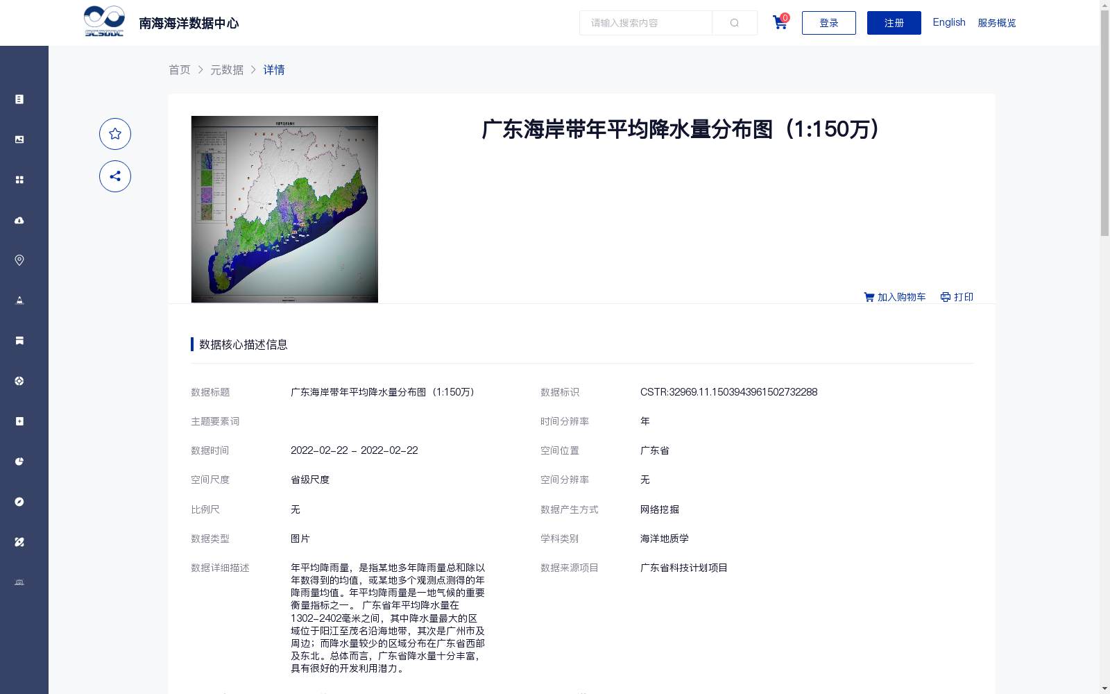
年平均降雨量,是指某地多年降雨量总和除以年数得到的均值,或某地多个观测点测得的年降雨量均值。年平均降雨量是一地气候的重要衡量指标之一。 广东省年平均降水量在1302-2402毫米之间,其中降水量最大的区域位于阳江至茂名沿海地带,其次是广州市及周边;而降水量较少的区域分布在广东省西部及东北。总体而言,广东省降水量十分丰富,具有很好的开发利用潜力。
Annual average precipitation refers to the mean value obtained by dividing the total annual precipitation of a location across multiple years by the number of years, or the mean annual precipitation measured by multiple observation stations at that location. Annual average precipitation is one of the key indicators for assessing the climate of a region. The annual average precipitation in Guangdong Province ranges from 1302 to 2402 millimeters. The region with the highest precipitation lies along the coastal stretch from Yangjiang to Maoming, followed by Guangzhou and its surrounding areas; regions with relatively low precipitation are distributed in the western and northeastern parts of Guangdong Province. Overall, Guangdong Province has abundant precipitation and considerable potential for development and utilization.
提供机构:
广州海洋地质调查局
搜集汇总
数据集介绍
背景与挑战
背景概述
该数据集是广东省海岸带的年平均降水量分布图,比例为1:150万,以图片形式呈现。数据显示广东省年平均降水量在1302-2402毫米之间,降水量最大的区域集中在阳江至茂名沿海地带和广州市周边,而西部及东北地区相对较少,整体降水量丰富,具有较好的开发利用潜力。数据来源于广东省科技计划项目,通过网络挖掘整合生产,质量可靠,并完全开放共享。
以上内容由遇见数据集搜集并总结生成


