2020 年中国生态系统数据
收藏地球大数据科学工程2024-03-04 收录
下载链接:
https://data.casearth.cn/sdo/detail/653f535e819aec161b3b4670
下载链接
链接失效反馈官方服务:
资源简介:
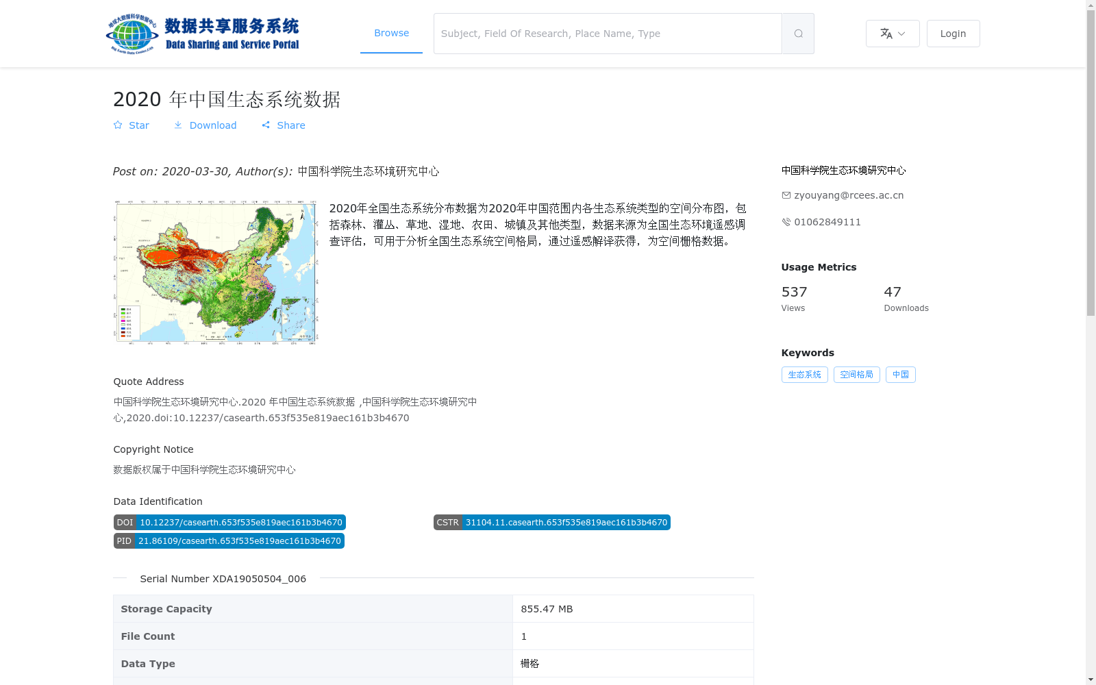
2020年全国生态系统分布数据为2020年中国范围内各生态系统类型的空间分布图,包括森林、灌丛、草地、湿地、农田、城镇及其他类型,数据来源为全国生态环境遥感调查评估,可用于分析全国生态系统空间格局,通过遥感解译获得,为空间栅格数据。
The 2020 National Ecosystem Distribution Dataset is a spatial distribution map of various ecosystem types across China in 2020, covering forest, shrubland, grassland, wetland, cropland, urban and other categories. Sourced from the national ecological environment remote sensing survey and assessment, this dataset was obtained through remote sensing interpretation, is spatial raster data, and can be used to analyze the national ecosystem spatial pattern.
提供机构:
中国科学院生态环境研究中心
搜集汇总
数据集介绍
背景与挑战
背景概述
该数据集是2020年中国生态系统空间分布数据,由中国科学院生态环境研究中心基于全国生态环境遥感调查评估通过遥感解译生成,以栅格格式(.tif)提供,涵盖森林、灌丛、草地、湿地、农田、城镇等生态系统类型,主要用于分析全国生态系统空间格局。
以上内容由遇见数据集搜集并总结生成


