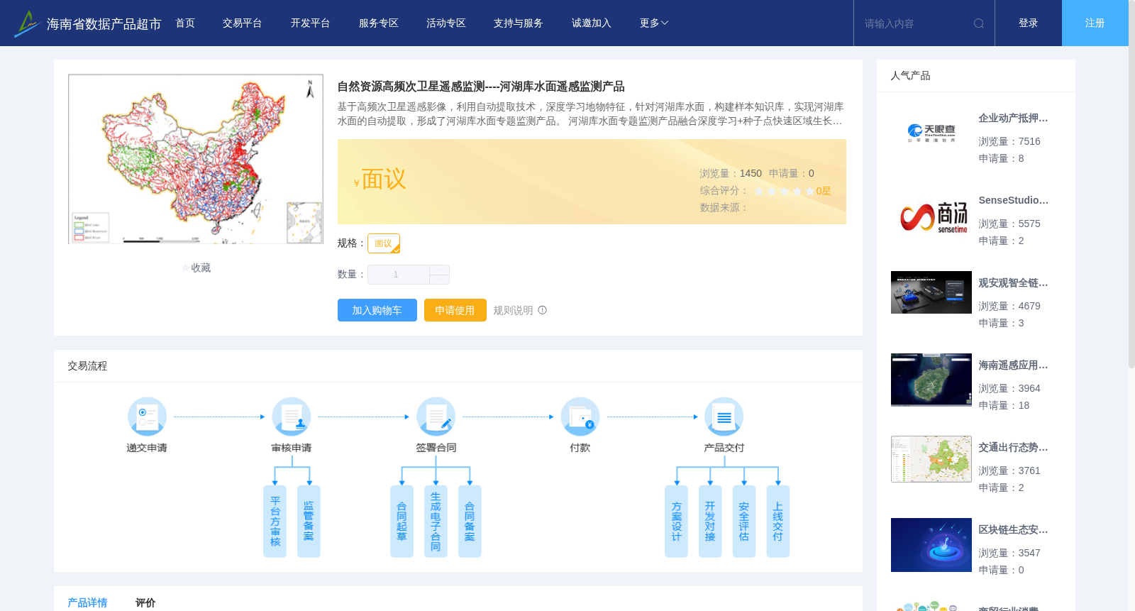
自然资源高频次卫星遥感监测----河湖库水面遥感监测产品
收藏海南省数据产品超市2023-07-24 更新2024-03-01 收录
下载链接:
https://www.datadex.cn/app/buyApi?id=ce7b04025f9145bc888b2f8fa1fb39dc
下载链接
链接失效反馈官方服务:
资源简介:
基于高频次卫星遥感影像,利用自动提取技术,深度学习地物特征,针对河湖库水面,构建样本知识库,实现河湖库水面的自动提取,形成了河湖库水面专题监测产品。
河湖库水面专题监测产品融合深度学习+种子点快速区域生长等技术,基于2米级影像实现了全国主要河湖库水体信息高精度,全自动快速提取。针对全国一至三级河流水面,开展1年2次的卫星遥感监测,监测河湖库水面的面积与变化信息,1平方公里以上湖泊和水库水面面积与变化信息,形成河湖库水面遥感监测信息产品。全国水面(三级以上河流, 1 km² 以上湖泊、水库)自动提取总体面积精度优于85%,其中湖泊、水库精度优于90%,10台GPU机器约5天可完成全国一版自动提取。
Based on high-frequency satellite remote sensing images, leveraging automatic extraction technology and deep learning to learn ground object features, we built a sample knowledge base targeting the water surfaces of rivers, lakes and reservoirs, realized automatic extraction of these water surfaces, and developed thematic monitoring products for rivers, lakes and reservoirs water surfaces.
The thematic monitoring products for rivers, lakes and reservoirs water surfaces incorporate technologies including deep learning and rapid region growing based on seed points. Based on 2-meter-resolution images, they enable high-precision, fully automatic and rapid extraction of water body information for major rivers, lakes and reservoirs across the country.
We conduct satellite remote sensing monitoring twice a year for the water surfaces of first- to third-order rivers nationwide, as well as the area and variation information of rivers, lakes and reservoirs water surfaces, and the area and variation information of lakes and reservoirs with an area of 1 km² or larger, to generate remote sensing monitoring information products for rivers, lakes and reservoirs water surfaces.
For national water bodies (rivers above third-order, lakes and reservoirs with an area ≥1 km²), the overall area extraction accuracy of automatic extraction exceeds 85%, with the accuracy for lakes and reservoirs exceeding 90%. One national-scale automatic extraction can be completed in approximately 5 days using 10 GPU machines.
提供机构:
北京四维空间数码科技有限公司
创建时间:
2023-07-24
搜集汇总
数据集介绍
背景与挑战
背景概述
该数据集基于2米级卫星影像和深度学习技术,实现全国三级河流及1平方公里以上湖泊水库水面的自动提取,年监测2次,总体精度达85%以上。采用GPU集群可在5天内完成全国范围处理,生成水体面积及变化信息产品。
以上内容由遇见数据集搜集并总结生成


