SMAP卫星9公里土壤水分与植被光学厚度逐日产品(多通道协同反演算法,2015-2024)
收藏国家青藏高原科学数据中心2024-10-16 更新2024-03-06 收录
下载链接:
https://data.tpdc.ac.cn/zh-hans/data/1b7ac4f8-f8a6-4734-8a23-0d23a19e42b5
下载链接
链接失效反馈官方服务:
资源简介:
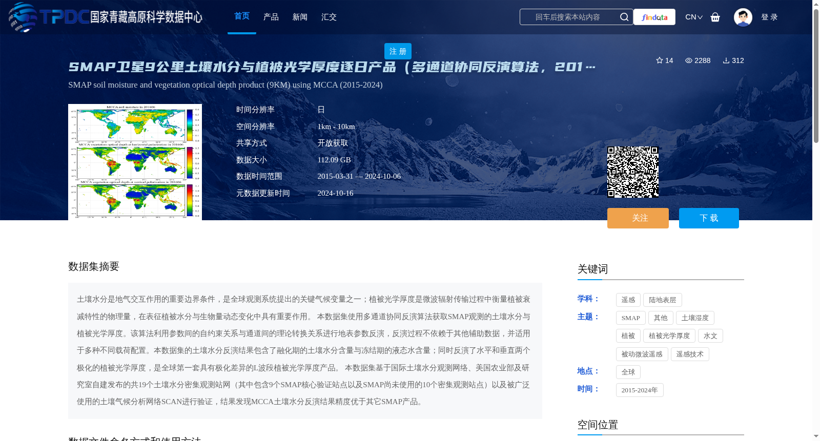
土壤水分是地气交互作用的重要边界条件,是全球观测系统提出的关键气候变量之一;植被光学厚度是微波辐射传输过程中衡量植被衰减特性的物理量,在表征植被水分与生物量动态变化中具有重要作用。
本数据集使用多通道协同反演算法获取SMAP观测的土壤水分与植被光学厚度。该算法利用参数间的自约束关系与通道间的理论转换关系进行地表参数反演,反演过程不依赖于其他辅助数据,并适用于多种不同载荷配置。本数据集的土壤水分反演结果包含了融化期的土壤水分含量与冻结期的液态水含量;同时反演了水平和垂直两个极化的植被光学厚度,是全球第一套具有极化差异的L波段植被光学厚度产品。
本数据集基于国际土壤水分观测网络、美国农业部及研究室自建发布的共19个土壤水分密集观测站网(其中包含9个SMAP核心验证站点以及SMAP尚未使用的10个密集观测站点)以及被广泛使用的土壤气候分析网络SCAN进行验证,结果发现MCCA土壤水分反演结果精度优于其它SMAP产品。
Soil moisture is a critical boundary condition for land-atmosphere interactions, and is one of the key climate variables proposed by the Global Observing System. Vegetation Optical Depth (VOD) is a physical quantity that quantifies vegetation attenuation characteristics during microwave radiative transfer, and plays a vital role in characterizing dynamic changes in vegetation water content and biomass.
This dataset employs a multi-channel collaborative inversion algorithm to retrieve soil moisture and Vegetation Optical Depth (VOD) from SMAP observations. The algorithm leverages self-constrained relationships between parameters and theoretical transformation relationships between channels to conduct surface parameter inversion; the inversion process does not rely on any external auxiliary data, and is compatible with diverse sensor load configurations. The soil moisture retrieval results of this dataset cover soil moisture content during the melting period and liquid water content during the freezing period. Additionally, it retrieves VOD under both horizontal and vertical polarizations, making it the world's first L-band VOD product suite with polarization differences.
This dataset is validated using a total of 19 dense soil moisture observation networks, including those from the International Soil Moisture Network (ISMN), the United States Department of Agriculture (USDA), and self-established and released networks by the research laboratory. Among these 19 networks, 9 are SMAP core validation sites and 10 have not been utilized by SMAP yet, alongside the widely used Soil Climate Analysis Network (SCAN). Validation results demonstrate that the soil moisture retrieval outputs from MCCA outperform other SMAP products in terms of accuracy.
提供机构:
彭志晴,赵天杰,姚盼盼,施建成
创建时间:
2023-04-21
搜集汇总
数据集介绍
背景与挑战
背景概述
该数据集是SMAP卫星生成的9公里分辨率土壤水分与植被光学厚度逐日产品,采用多通道协同反演算法(MCCA),覆盖2015年至2024年。数据集包含土壤水分和植被光学厚度两个关键变量,其中土壤水分反演结果包含融化期和冻结期的水分含量,植被光学厚度则提供了水平和垂直两个极化的数据,是全球首套具有极化差异的L波段植被光学厚度产品,且经过验证精度优于其他SMAP产品。
以上内容由遇见数据集搜集并总结生成


