青藏高原NDVI数据集(2001-2020)
收藏国家青藏高原科学数据中心2023-01-11 更新2024-03-06 收录
下载链接:
https://data.tpdc.ac.cn/zh-hans/data/0adedc6a-c0af-40fc-9362-6e3246cb9347
下载链接
链接失效反馈官方服务:
资源简介:
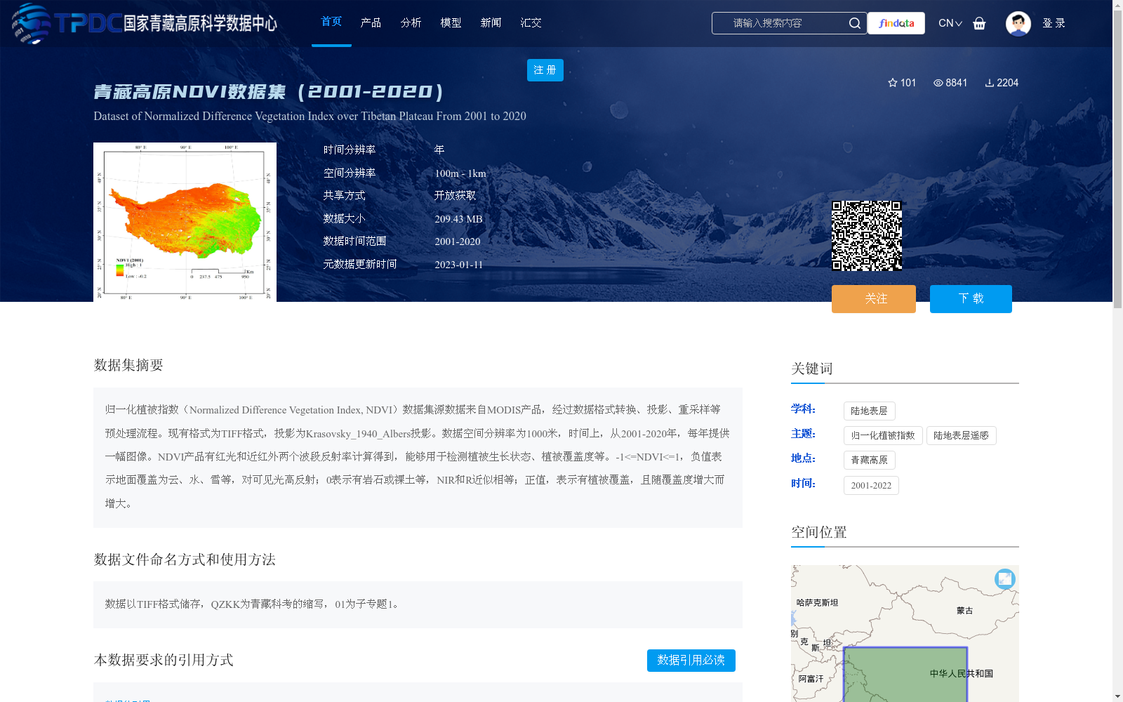
归一化植被指数(Normalized Difference Vegetation Index, NDVI)数据集源数据来自MODIS产品,经过数据格式转换、投影、重采样等预处理流程。现有格式为TIFF格式,投影为Krasovsky_1940_Albers投影。数据空间分辨率为1000米,时间上,从2001-2020年,每年提供一幅图像。NDVI产品有红光和近红外两个波段反射率计算得到,能够用于检测植被生长状态、植被覆盖度等。-1<=NDVI<=1,负值表示地面覆盖为云、水、雪等,对可见光高反射;0表示有岩石或裸土等,NIR和R近似相等;正值,表示有植被覆盖,且随覆盖度增大而增大。
The source data of the Normalized Difference Vegetation Index (NDVI) dataset is derived from MODIS products, and has undergone preprocessing workflows including data format conversion, projection transformation and resampling. The data is currently stored in TIFF format with the Krasovsky_1940_Albers projection. The spatial resolution of the dataset is 1000 meters, and temporally, one image is provided annually from 2001 to 2020. NDVI is calculated using the reflectance values of the red and near-infrared bands, and can be utilized to detect vegetation growth status, vegetation coverage and other related ecological indicators. The value range of NDVI is -1 ≤ NDVI ≤ 1: negative values indicate ground covers such as clouds, water or snow, which have high visible light reflectance; a value of 0 represents rocks or bare soil, where the near-infrared (NIR) and red (R) reflectances are approximately equal; positive values correspond to vegetation cover, and the NDVI value increases with the increase of vegetation coverage.
提供机构:
朱军涛
创建时间:
2022-06-04
搜集汇总
数据集介绍
背景与挑战
背景概述
该数据集提供了青藏高原2001年至2020年的归一化植被指数(NDVI)数据,源自MODIS产品并经过预处理,以TIFF格式存储,空间分辨率为1000米,每年一幅图像。NDVI值范围从-1到1,用于监测植被生长状态和覆盖度变化,适用于陆地表层遥感研究。数据集具有开放获取特性,时间跨度为20年,支持对青藏高原植被动态的长期分析。
以上内容由遇见数据集搜集并总结生成


