南师大仙林北区倾斜摄影实景三维模型14期数据(20220118-20230301)
收藏国家地球系统科学数据中心2024-10-22 更新2024-09-21 收录
下载链接:
https://www.geodata.cn/data/datadetails.html?dataguid=50105316118639&docId=2308
下载链接
链接失效反馈官方服务:
资源简介:
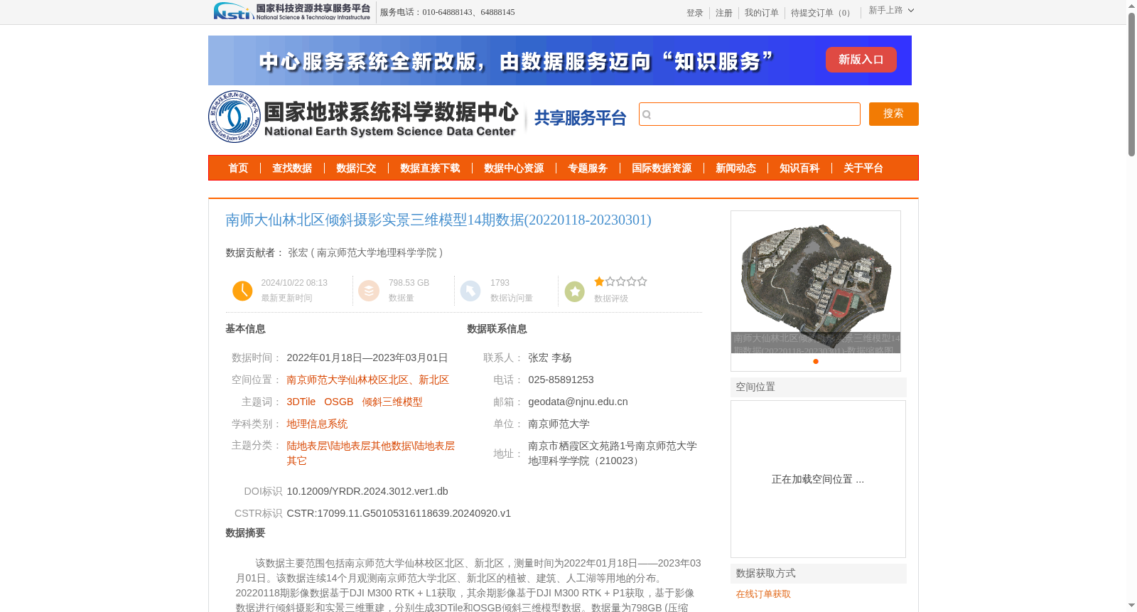
该数据主要范围包括南京师范大学仙林校区北区、新北区,测量时间为2022年01月18日——2023年03月01日。该数据连续14个月观测南京师范大学北区、新北区的植被、建筑、人工湖等用地的分布。20220118期影像数据基于DJI M300 RTK + L1获取,其余期影像基于DJI M300 RTK + P1获取,基于影像数据进行倾斜摄影和实景三维重建,分别生成3DTile和OSGB倾斜三维模型数据。数据量为798GB (压缩包)。
This dataset covers primarily the North and New North Areas of Xianlin Campus, Nanjing Normal University, with data collected between January 18, 2022 and March 1, 2023. Over a continuous 14-month period, this dataset monitored the spatial distribution of land categories including vegetation, buildings, and artificial lakes in the target areas. The January 18, 2022 batch of image data was acquired using DJI M300 RTK + L1, while all other batches of image data were captured using DJI M300 RTK + P1. Oblique photogrammetry and real-scene 3D reconstruction were performed on the acquired image data to generate 3DTile and OSGB oblique 3D model data, respectively. The total size of the compressed dataset is 798 GB.
提供机构:
南京师范大学地理科学学院
创建时间:
2024-09-20
搜集汇总
数据集介绍
背景与挑战
背景概述
该数据集包含南京师范大学仙林校区北区、新北区连续14个月的倾斜摄影实景三维模型数据,数据量为798.53GB,采用3DTile和OSGB格式,基于DJI M300 RTK + P1和L1设备获取,具有高精度(平面精度3cm)和详细的植被、建筑、人工湖等用地分布信息。
以上内容由遇见数据集搜集并总结生成


