1985年中国30m分辨率湖泊透明度遥感反演数据集
收藏国家地球系统科学数据中心2023-09-12 更新2024-04-21 收录
下载链接:
https://www.geodata.cn/data/datadetails.html?dataguid=25883778956913&docId=4544
下载链接
链接失效反馈官方服务:
资源简介:
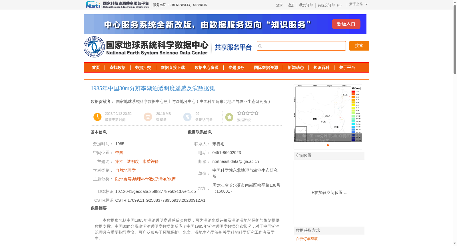
本数据集包括中国1985年湖泊透明度遥感反演数据,可为湖泊水质评价及湖泊湿地的保护与恢复提供数据支撑。中国30m分辨率湖泊透明度数据集反应了中国1985年湖泊透明度数据分布状况,对于中国湖泊治理具有重要指导意义。可广泛服务于环境保护、水文、湿地生态学等相关学科的科学研究工作者及学生。
This dataset encompasses remotely sensed inversion data of lake transparency across China in 1985, offering data support for lake water quality evaluation and the conservation and restoration of lake wetlands. The 30-meter-resolution lake transparency dataset of China reflects the spatial distribution of lake transparency data across China in 1985, holding significant guiding value for lake governance in the country. It can be widely utilized by scientific researchers and students in relevant disciplines including environmental protection, hydrology, and wetland ecology.
提供机构:
中国科学院东北地理与农业生态研究所
创建时间:
2023-09-12
搜集汇总
数据集介绍
背景与挑战
背景概述
该数据集提供了1985年中国湖泊透明度的30米分辨率遥感反演数据,适用于湖泊水质评价及湿地保护与恢复研究。数据来源于Landsat影像,经过严格的质量控制,具有较高的可靠性和精度,可为环境保护、水文和湿地生态学等领域的科研工作提供重要支持。
以上内容由遇见数据集搜集并总结生成


