青藏高原地区30米分辨率卫星遥感影像产品(2018)
收藏国家青藏高原科学数据中心2021-07-06 更新2024-03-06 收录
下载链接:
https://data.tpdc.ac.cn/zh-hans/data/30baaf5e-3366-44ac-aef2-60fb1865612b
下载链接
链接失效反馈官方服务:
资源简介:
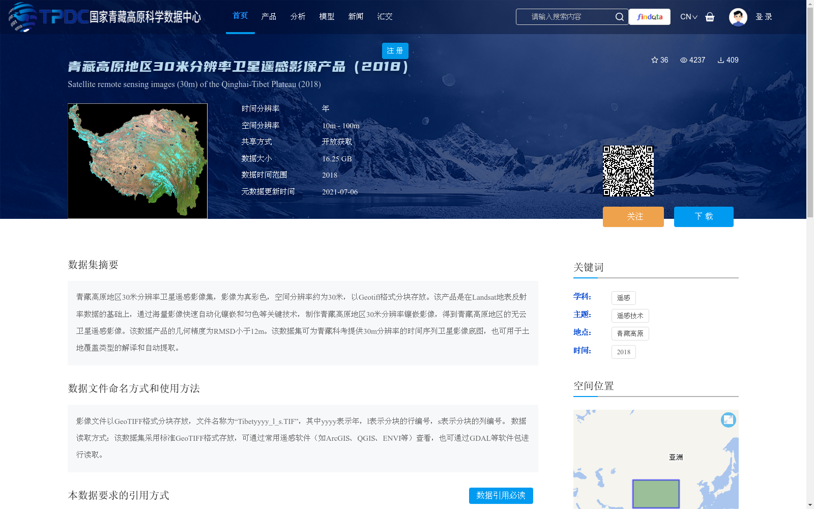
青藏高原地区30米分辨率卫星遥感影像集,影像为真彩色,空间分辨率约为30米,以Geotiff格式分块存放。该产品是在Landsat地表反射率数据的基础上,通过海量影像快速自动化镶嵌和匀色等关键技术,制作青藏高原地区30米分辨率镶嵌影像,得到青藏高原地区的无云卫星遥感影像。该数据产品的几何精度为RMSD小于12m。该数据集可为青藏科考提供30m分辨率的时间序列卫星影像底图,也可用于土地覆盖类型的解译和自动提取。
A satellite remote sensing image dataset of the Qinghai-Tibet Plateau with 30-meter resolution. The images are true-color composites, featuring a spatial resolution of approximately 30 meters, and are stored in tiled GeoTIFF format. Developed based on Landsat surface reflectance data, this product leverages key technologies including rapid automated mosaicking and color balancing for large-scale remote sensing image datasets to produce 30-meter resolution mosaic images of the Qinghai-Tibet Plateau, ultimately yielding cloud-free satellite remote sensing imagery of the region. The geometric accuracy of this dataset is ensured with a root mean square deviation (RMSD) of less than 12 meters. This dataset can provide time-series satellite remote sensing base maps for the Qinghai-Tibet Plateau Scientific Expedition, and can also be used for the interpretation and automated extraction of land cover types.
提供机构:
龙腾飞
创建时间:
2021-04-26
搜集汇总
数据集介绍
背景与挑战
背景概述
该数据集是2018年青藏高原地区的30米分辨率卫星遥感影像产品,基于Landsat数据通过自动化镶嵌和匀色技术生成真彩色无云影像,几何精度高(RMSD小于12米)。它以GeoTIFF格式分块存放,数据大小为16.25 GB,适用于青藏科考底图、土地覆盖解译和自动提取等应用。
以上内容由遇见数据集搜集并总结生成


