2008、2017、2018三期南极半岛周边植被分类
收藏地球大数据科学工程2024-04-21 收录
下载链接:
https://data.casearth.cn/sdo/detail/636e17ec819aec5df66b51f9
下载链接
链接失效反馈官方服务:
资源简介:
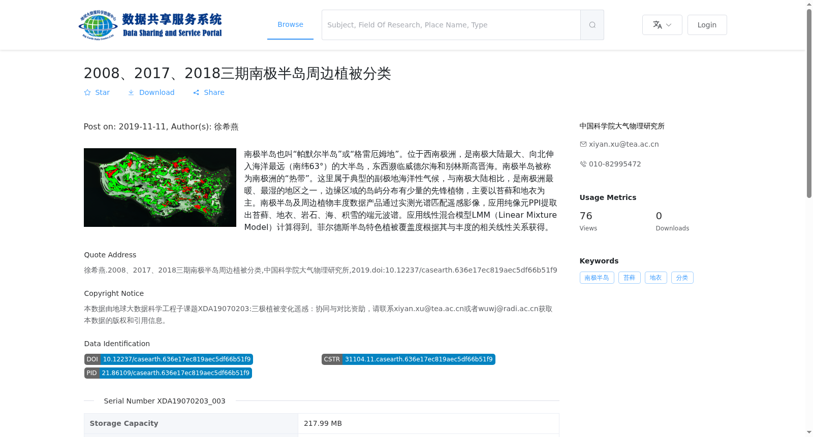
南极半岛也叫“帕默尔半岛”或“格雷厄姆地”。位于西南极洲,是南极大陆最大、向北伸入海洋最远(南纬63°)的大半岛,东西濒临威德尔海和别林斯高晋海。南极半岛被称为南极洲的“热带”。这里属于典型的副极地海洋性气候,与南极大陆相比,是南极洲最暖、最湿的地区之一,边缘区域的岛屿分布有少量的先锋植物,主要以苔藓和地衣为主。南极半岛及周边植物丰度数据产品通过实测光谱匹配遥感影像,应用纯像元PPI提取出苔藓、地衣、岩石、海、积雪的端元波谱。应用线性混合模型LMM(Linear Mixture Model)计算得到。菲尔德斯半岛特色植被覆盖度根据其与丰度的相关线性关系获得。
The Antarctic Peninsula, also known as Palmer Peninsula or Graham Land, is situated in West Antarctica. It is the largest peninsula of the Antarctic continent, extending farthest north into the ocean at 63°S, with the Weddell Sea and Bellingshausen Sea bordering its eastern and western sides respectively. The Antarctic Peninsula is hailed as the "tropics" of Antarctica. Featuring a typical subpolar maritime climate, it ranks among the warmest and wettest regions in Antarctica when compared to the mainland Antarctic continent. A small amount of pioneer vegetation, mainly composed of mosses and lichens, grows on the islands in its marginal areas.
The plant abundance data product for the Antarctic Peninsula and its surrounding regions is developed by matching field-measured spectra with remote sensing images, and extracting endmember spectra of mosses, lichens, rocks, seawater and snow cover using the pure pixel PPI (Pixel Purity Index) method. This product is generated via the Linear Mixture Model (LMM). The characteristic vegetation coverage of the Fildes Peninsula is derived from its linear correlation with the plant abundance.
提供机构:
中国科学院大气物理研究所
搜集汇总
数据集介绍
背景与挑战
背景概述
该数据集提供了2008、2017、2018年南极半岛周边植被分类的遥感数据,主要关注苔藓和地衣的分类,通过实测光谱和遥感影像匹配技术生成。数据集包含40个GeoTiff格式文件,总容量为217.99 MB,适用于研究南极半岛植被分布及变化。
以上内容由遇见数据集搜集并总结生成


