青藏高原土地资源要素数据(1990-2015)
收藏国家青藏高原科学数据中心2021-04-19 更新2024-03-01 收录
下载链接:
https://data.tpdc.ac.cn/zh-hans/data/939571dc-1545-4404-8d8c-d2308687baf4
下载链接
链接失效反馈官方服务:
资源简介:
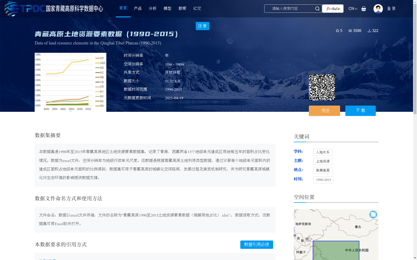
本数据集是1990年至2015年青藏高原地区土地资源要素数据集,记录了青海、西藏两省15个地级单元建成区用地每五年的面积占比变化情况。数据为excel文件,空间分辨率为地级行政单元尺度。该数据是根据青藏高原土地利用类型数据,通过计算每个地级单元面积内的建成区面积占地级单元面积的比例得到,数据集可用于青藏高原的城镇化空间格局、发展过程及演变机制研究,并为研究青藏高原城镇化对生态环境的影响提供数据支撑。
This dataset is the Land Resource Elements Dataset of the Qinghai-Tibet Plateau spanning from 1990 to 2015. It documents the five-year changes in the proportion of built-up land area to the total area of 15 prefecture-level administrative units in Qinghai Province and the Tibet Autonomous Region. The data is stored in Excel files, with a spatial resolution at the prefecture-level administrative unit scale. This dataset is derived by calculating the ratio of built-up land area within each prefecture-level unit to the total area of that unit, based on the land use type data of the Qinghai-Tibet Plateau. It can be used to study the spatial pattern, development process and evolution mechanism of urbanization on the Qinghai-Tibet Plateau, and provide data support for research on the impacts of urbanization on the ecological environment of the Qinghai-Tibet Plateau.
提供机构:
杜云艳,易嘉伟
创建时间:
2019-11-21
搜集汇总
数据集介绍
背景与挑战
背景概述
该数据集是1990年至2015年青藏高原地区土地资源要素数据,以Excel文件形式存储,记录了青海和西藏两省15个地级单元建成区用地每五年的面积占比变化,空间分辨率为地级行政单元尺度。数据可用于分析青藏高原的城镇化空间格局、发展过程及演变机制,并为研究城镇化对生态环境的影响提供数据支持。
以上内容由遇见数据集搜集并总结生成


