尼泊尔年度滑坡编目数据集
收藏地球大数据科学工程2026-01-06 更新2026-01-10 收录
下载链接:
https://data.casearth.cn/dataset/695cc76f97d0b0397735c9af
下载链接
链接失效反馈官方服务:
资源简介:
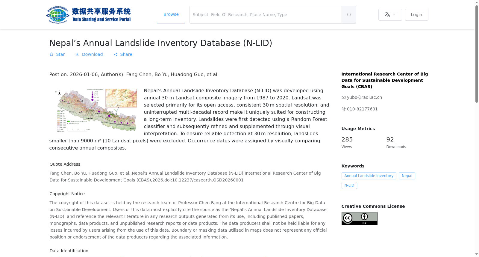
尼泊尔年度滑坡编目数据集(N-LID)利用 1987 年至 2020 年 30 米分辨率的 Landsat 年度合成影像构建 。选取 Landsat 数据源主要基于其开放获取特性、一致的 30 米空间分辨率以及连续的多年代际记录,这些特征使其适于构建长时序滑坡编目 。滑坡提取首先采用随机森林分类器进行初步检测,随后通过人工目视解译进行精化与增补 。为确保 30 米分辨率下的检测可靠性,剔除了面积小于 9000 平方米(约 10 个 Landsat 像元)的滑坡 。滑坡发生时间通过对比连续年份的合成影像目视判定 。
The Nepal Annual Landslide Inventory Dataset (N-LID) was constructed using annual composite Landsat imagery with 30-meter resolution spanning from 1987 to 2020. The Landsat data source was selected primarily for its open accessibility, consistent 30-meter spatial resolution, and continuous multi-decadal records, which render it suitable for developing long-term landslide inventories. Landslide extraction was initially detected using a random forest classifier, followed by refinement and supplementation via manual visual interpretation. To ensure detection reliability at 30-meter resolution, landslides with an area smaller than 9000 square meters (approximately 10 Landsat pixels) were excluded. The occurrence time of landslides was determined visually by comparing composite images from consecutive years.
创建时间:
2026-01-06
搜集汇总
数据集介绍
背景与挑战
背景概述
该数据集是基于1987年至2020年年度30米Landsat影像开发的尼泊尔滑坡编目数据库,采用随机森林分类器和目视解译相结合的方法检测滑坡,并排除了面积小于9000平方米的小型滑坡以确保数据可靠性。数据集具有30米空间分辨率和单年时间分辨率,覆盖尼泊尔特定经纬度范围,以ESRI Shapefile矢量格式提供,适用于长期滑坡监测和遥感分析研究。
以上内容由遇见数据集搜集并总结生成


