青藏高原土壤水蚀强度数据集(1982-2020)
收藏国家青藏高原科学数据中心2024-12-03 更新2025-01-04 收录
下载链接:
https://data.tpdc.ac.cn/zh-hans/data/85a7e085-3ff2-433e-95dd-fb30862d74ad
下载链接
链接失效反馈官方服务:
资源简介:
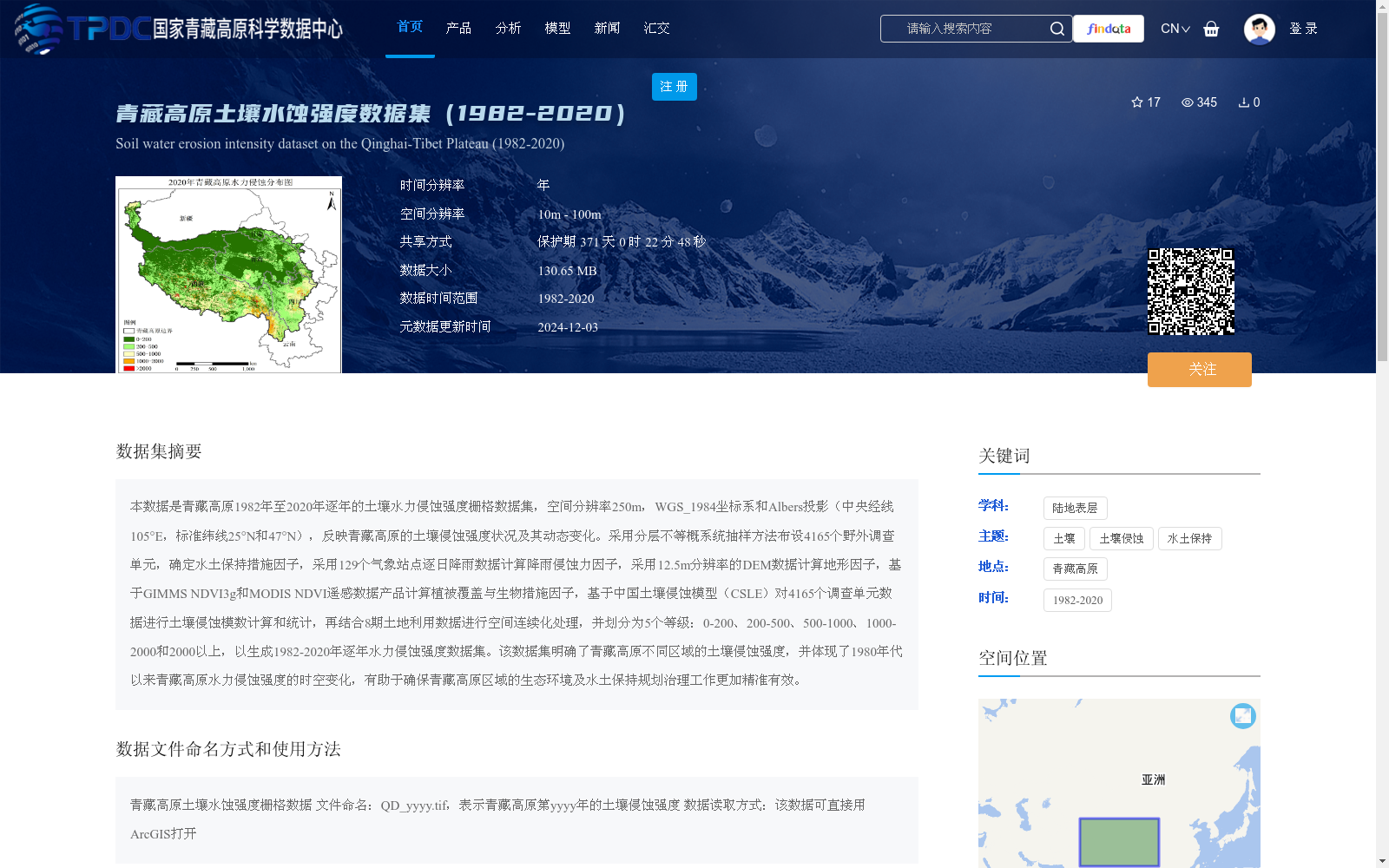
本数据是青藏高原1982年至2020年逐年的土壤水力侵蚀强度栅格数据集,空间分辨率250m,WGS_1984坐标系和Albers投影(中央经线105°E,标准纬线25°N和47°N),反映青藏高原的土壤侵蚀强度状况及其动态变化。采用分层不等概系统抽样方法布设4165个野外调查单元,确定水土保持措施因子,采用129个气象站点逐日降雨数据计算降雨侵蚀力因子,采用12.5m分辨率的DEM数据计算地形因子,基于GIMMS NDVI3g和MODIS NDVI遥感数据产品计算植被覆盖与生物措施因子,基于中国土壤侵蚀模型(CSLE)对4165个调查单元数据进行土壤侵蚀模数计算和统计,再结合8期土地利用数据进行空间连续化处理,并划分为5个等级:0-200、200-500、500-1000、1000-2000和2000以上,以生成1982-2020年逐年水力侵蚀强度数据集。该数据集明确了青藏高原不同区域的土壤侵蚀强度,并体现了1980年代以来青藏高原水力侵蚀强度的时空变化,有助于确保青藏高原区域的生态环境及水土保持规划治理工作更加精准有效。
This is an annual grid dataset of soil water erosion intensity on the Qinghai-Tibet Plateau spanning from 1982 to 2020, with a spatial resolution of 250 m, adopting the WGS_1984 coordinate system and Albers projection (central meridian: 105°E, standard parallels: 25°N and 47°N). This dataset characterizes the status and dynamic variations of soil erosion intensity across the Qinghai-Tibet Plateau.
To develop this dataset, 4,165 field survey units were deployed using stratified unequal probability systematic sampling. The soil and water conservation practice factor was determined; rainfall erosivity factor was calculated using daily rainfall records from 129 meteorological stations; topographic factors were derived from 12.5 m resolution DEM data; and vegetation cover and biological practice factor was computed based on GIMMS NDVI3g and MODIS NDVI remote sensing products. Soil erosion modulus was calculated and statistically analyzed for all 4,165 survey units via the Chinese Soil Loss Equation (CSLE). Subsequently, spatial continuous processing was conducted in combination with 8-period land use datasets, and the results were categorized into 5 intensity grades: 0–200, 200–500, 500–1000, 1000–2000, and >2000, to finalize the annual water erosion intensity dataset for the period 1982–2020.
This dataset clarifies the spatial distribution of soil erosion intensity across different regions of the Qinghai-Tibet Plateau, and reveals the spatiotemporal changes in water erosion intensity on the Plateau since the 1980s. It supports more accurate and effective ecological environment protection and soil and water conservation planning, governance, and restoration efforts in the Qinghai-Tibet Plateau region.
提供机构:
章文波
创建时间:
2024-12-03
搜集汇总
数据集介绍
背景与挑战
背景概述
该数据集是青藏高原1982年至2020年逐年的土壤水力侵蚀强度栅格数据,空间分辨率250米,基于中国土壤侵蚀模型(CSLE)结合野外调查、气象、地形和遥感数据生成,将侵蚀强度划分为五个等级。它旨在反映青藏高原土壤侵蚀的时空变化,支持生态环境和水土保持规划工作,数据来源于国家科技重大专项资助项目。
以上内容由遇见数据集搜集并总结生成


