青藏高原农业区耕地分布数据集(1988-2024)
收藏国家青藏高原科学数据中心2026-01-23 更新2026-01-24 收录
下载链接:
https://data.tpdc.ac.cn/zh-hans/data/db58b4ad-55ab-475d-8fe8-9b8f3386efef
下载链接
链接失效反馈官方服务:
资源简介:
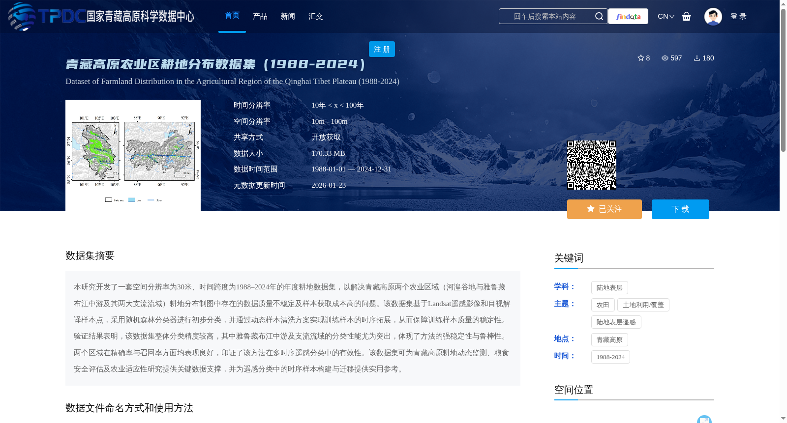
本研究开发了一套空间分辨率为30米、时间跨度为1988–2024年的年度耕地数据集,以解决青藏高原两个农业区域(河湟谷地与雅鲁藏布江中游及其两大支流流域)耕地分布制图中存在的数据质量不稳定及样本获取成本高的问题。该数据集基于Landsat遥感影像和目视解译样本点,采用随机森林分类器进行初步分类,并通过动态样本清洗方案实现训练样本的时序拓展,从而保障训练样本质量的稳定性。验证结果表明,该数据集整体分类精度较高,其中雅鲁藏布江中游及支流流域的分类性能尤为突出,体现了方法的强稳定性与鲁棒性。两个区域在精确率与召回率方面均表现良好,印证了该方法在多时序遥感分类中的有效性。该数据集可为青藏高原耕地动态监测、粮食安全评估及农业适应性研究提供关键数据支撑,并为遥感分类中的时序样本构建与迁移提供实用参考。
This study developed an annual cropland dataset with a spatial resolution of 30 meters and a temporal span from 1988 to 2024, aiming to address the issues of unstable data quality and high sample acquisition cost in cropland distribution mapping of two agricultural regions on the Qinghai-Tibet Plateau: the Hehuang Valley, and the middle reaches of the Yarlung Zangbo River and its two major tributary basins. Built upon Landsat remote sensing imagery and visual interpretation sample points, the dataset adopted a random forest classifier for preliminary classification, and realized temporal expansion of training samples via a dynamic sample cleaning scheme, thereby ensuring the stability of training sample quality. Validation results demonstrate that the dataset achieves a high overall classification accuracy, with the classification performance in the middle reaches of the Yarlung Zangbo River and its tributary basins being particularly outstanding, which reflects the strong stability and robustness of the proposed method. Both of the two regions perform excellently in terms of precision and recall, verifying the effectiveness of the method in multi-temporal remote sensing classification. This dataset can provide critical data support for cropland dynamic monitoring, food security assessment and agricultural adaptability research on the Qinghai-Tibet Plateau, and offer practical references for the construction and transfer of temporal samples in remote sensing classification.
提供机构:
夏兴生,吕圣慧,刘美娟,颜梦,陈琼,潘耀忠
创建时间:
2025-06-04
搜集汇总
数据集介绍
背景与挑战
背景概述
该数据集是青藏高原农业区1988-2024年年度耕地分布数据,空间分辨率为30米,覆盖河湟谷地与雅鲁藏布江中游及支流流域两个区域。基于Landsat遥感影像和随机森林分类器生成,通过动态样本清洗保障了分类精度和鲁棒性,主要用于耕地动态监测、粮食安全评估等研究。
以上内容由遇见数据集搜集并总结生成


