Dataset of Soil Erosion and Degradation in Black Soil Cropland of Northeast China
收藏DataCite Commons2025-04-27 更新2025-04-16 收录
下载链接:
https://www.scidb.cn/detail?dataSetId=51d35a3498b143c88c19c7ec101fe187
下载链接
链接失效反馈官方服务:
资源简介:
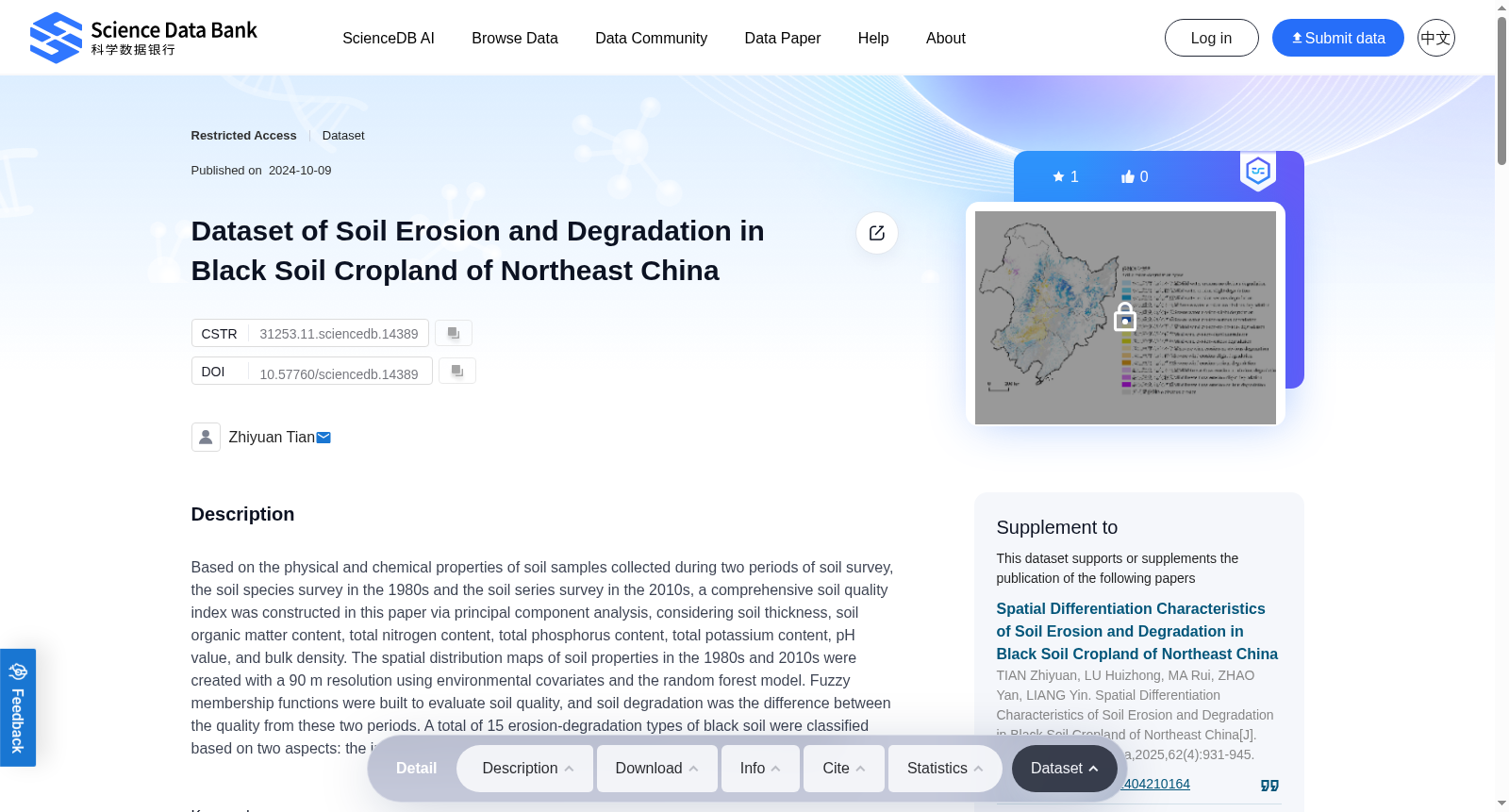
Based on the physical and chemical properties of soil samples collected during two periods of soil survey, the soil species survey in the 1980s and the soil series survey in the 2010s, a comprehensive soil quality index was constructed in this paper via principal component analysis, considering soil thickness, soil organic matter content, total nitrogen content, total phosphorus content, total potassium content, pH value, and bulk density. The spatial distribution maps of soil properties in the 1980s and 2010s were created with a 90 m resolution using environmental covariates and the random forest model. Fuzzy membership functions were built to evaluate soil quality, and soil degradation was the difference between the quality from these two periods. A total of 15 erosion-degradation types of black soil were classified based on two aspects: the intensity of soil erosion types and the degree of soil quality degradation.
本文基于1980年代土壤种类调查与2010年代土系调查两个时期采集的土壤样品理化性质,采用主成分分析(Principal Component Analysis),选取土壤厚度、土壤有机质含量、全氮含量、全磷含量、全钾含量、pH值及容重作为评价指标,构建了综合土壤质量指数。借助环境协变量与随机森林(Random Forest)模型,生成分辨率为90米的1980年代与2010年代土壤属性空间分布图。构建模糊隶属度函数(Fuzzy Membership Function)开展土壤质量评价,并以两时期土壤质量的差值表征土壤退化程度。基于土壤侵蚀类型强度与土壤质量退化程度两个维度,共划分出15种黑土侵蚀退化类型。
提供机构:
Science Data Bank
创建时间:
2024-10-09
搜集汇总
数据集介绍
背景与挑战
背景概述
该数据集提供了中国东北黑土区耕地土壤侵蚀和退化的详细研究数据,包括两个时期的土壤质量指数和空间分布图,以及15种侵蚀-退化类型的分类。数据集由中国科学院土壤科学研究所的田芷源等人创建,数据量为18.37 GB,包含20个文件。
以上内容由遇见数据集搜集并总结生成


