黑河中游绿洲农田500m逐日蒸散发数据集(2013-2016年)
收藏国家地球系统科学数据中心2021-05-19 更新2024-04-21 收录
下载链接:
https://www.geodata.cn/data/datadetails.html?dataguid=232518310378558&docId=11051
下载链接
链接失效反馈官方服务:
资源简介:
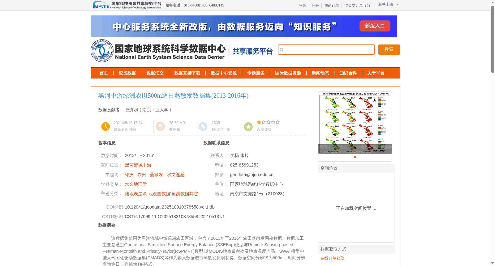
该数据集范围为黑河流域中游绿洲农田区域,包含了2013年至2016年农田蒸散发网格数据。数据加工主要是通过Operational Simplified Surface Energy Balance (SSEBop)模型与Remote Sensing-based Penman-Monteith and Priestly-Taylor(RSPMPT)模型,以MODIS地表反射率及地表温度产品、SWAT模型中国大气同化驱动数据集(CMADS)等作为输入数据进行蒸散发反演获得。数据空间分辨率为500m,时间分辨率为逐日,存储为TIF格式。
This dataset covers the oasis farmland region in the middle reaches of the Heihe River Basin, and contains grid farmland evapotranspiration data from 2013 to 2016. The data was generated through evapotranspiration inversion using the Operational Simplified Surface Energy Balance (SSEBop) model and the Remote Sensing-based Penman-Monteith and Priestly-Taylor (RSPMPT) model, with MODIS surface reflectance products, MODIS land surface temperature products, and the China Meteorological Assimilation Driving Datasets for the SWAT model (CMADS) as input datasets. This dataset has a spatial resolution of 500 meters, a daily temporal resolution, and is stored in TIF format.
提供机构:
南京工业大学
创建时间:
2021-05-13
搜集汇总
数据集介绍
背景与挑战
背景概述
该数据集覆盖黑河流域中游绿洲农田区域,提供了2013年至2016年逐日蒸散发数据,空间分辨率为500米。数据通过SSEBop和RSPMPT模型结合MODIS遥感产品和CMADS驱动数据集反演获得,适用于水文地理学和农田水循环研究,具有较高的时空精度和可靠性。
以上内容由遇见数据集搜集并总结生成


