闽三角城市群30m区域空间发展战略格局数据(2017年)
收藏国家地球系统科学数据中心2022-06-10 更新2024-04-21 收录
下载链接:
https://www.geodata.cn/data/datadetails.html?dataguid=22272651383051&docId=7547
下载链接
链接失效反馈官方服务:
资源简介:
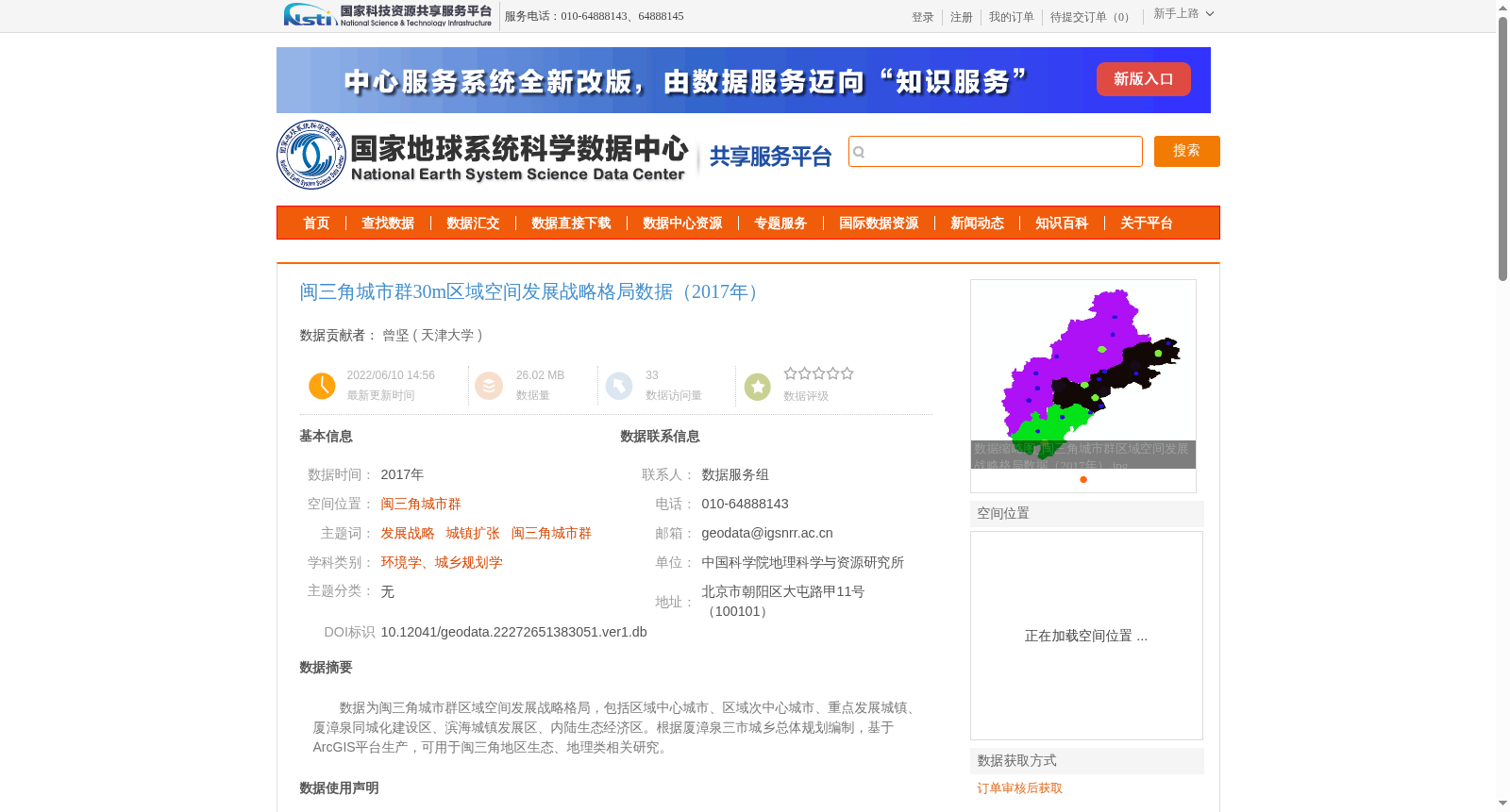
数据为闽三角城市群区域空间发展战略格局,包括区域中心城市、区域次中心城市、重点发展城镇、厦漳泉同城化建设区、滨海城镇发展区、内陆生态经济区。根据厦漳泉三市城乡总体规划编制,基于ArcGIS平台生产,可用于闽三角地区生态、地理类相关研究。
The dataset contains the spatial development strategic pattern of the Min-Triangle urban agglomeration, including regional central cities, regional sub-central cities, key development towns, Xiamen-Zhangzhou-Quanzhou urban integration construction zones, coastal town development zones, and inland ecological economic zones. It is compiled in accordance with the overall urban and rural master plans of the three cities of Xiamen, Zhangzhou and Quanzhou, and generated via the ArcGIS platform. This dataset is applicable for relevant ecological and geographical research in the Min-Triangle region.
提供机构:
天津大学
创建时间:
2022-06-10
搜集汇总
数据集介绍
背景与挑战
背景概述
该数据集提供了2017年闽三角城市群30m分辨率的区域空间发展战略格局数据,包括中心城市、重点发展城镇等空间规划信息,适用于生态和地理相关研究。数据基于三市城乡总体规划编制,具有较高的可靠性和专业性。
以上内容由遇见数据集搜集并总结生成


