南海准实时L4海表面高度填色图叠加地转流异常矢量及初步识别的中尺度涡边界图集(201909-202012)
收藏国家地球系统科学数据中心2021-06-02 更新2024-04-21 收录
下载链接:
https://www.geodata.cn/data/datadetails.html?dataguid=236918086268291&docId=11015
下载链接
链接失效反馈官方服务:
资源简介:
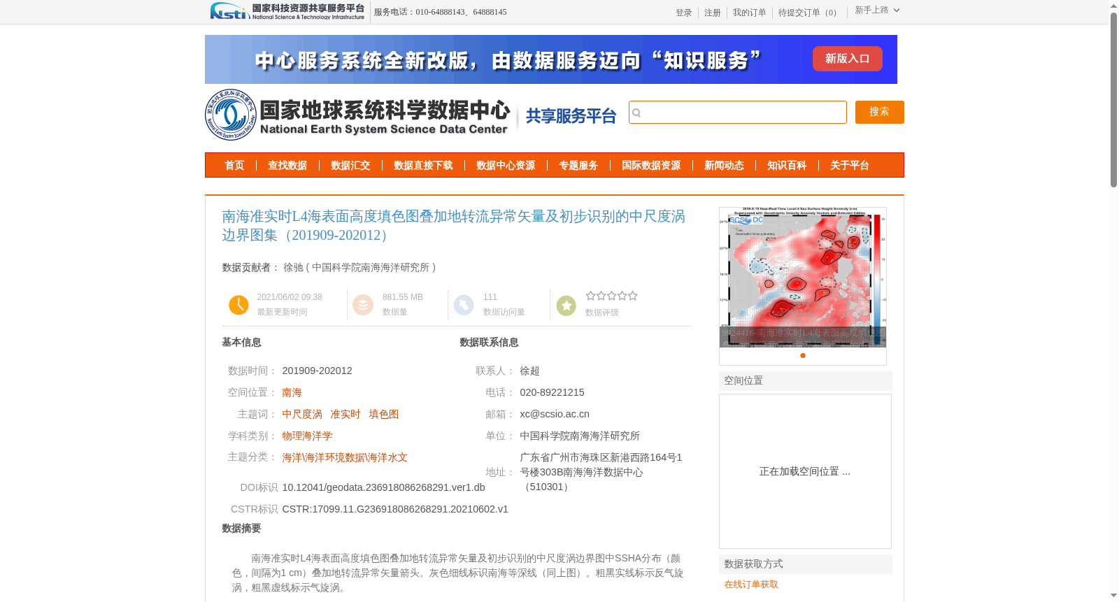
南海准实时L4海表面高度填色图叠加地转流异常矢量及初步识别的中尺度涡边界图中SSHA分布(颜色,间隔为1 cm)叠加地转流异常矢量箭头。灰色细线标识南海等深线(同上图)。粗黑实线标示反气旋涡,粗黑虚线标示气旋涡。
Near-real-time L4 sea surface height (SSHA, Sea Surface Height Anomaly) color-coded map of the South China Sea, overlain with geostrophic current anomaly vector arrows and preliminarily identified mesoscale eddy boundaries. The color scale for the SSHA distribution has an interval of 1 cm. Gray thin lines mark the South China Sea isobaths (consistent with the preceding figure). Thick solid black lines represent anticyclonic eddies, while thick dashed black lines represent cyclonic eddies.
提供机构:
中国科学院南海海洋研究所
创建时间:
2021-06-02
搜集汇总
数据集介绍
背景与挑战
背景概述
该数据集提供了南海地区2019年9月至2020年12月的准实时海表面高度填色图,叠加了地转流异常矢量及初步识别的中尺度涡边界,适用于物理海洋学领域的研究。数据基于公开卫星资料和自主生产方法,质量良好,适合用于科学研究。
以上内容由遇见数据集搜集并总结生成


