雅鲁藏布江流域高时空分辨率降水数据(1981-2016)
收藏国家青藏高原科学数据中心2022-04-18 更新2024-04-26 收录
下载链接:
https://data.tpdc.ac.cn/zh-hans/data/4fe3fce6-9134-4134-bebc-ed276c587d64
下载链接
链接失效反馈官方服务:
资源简介:
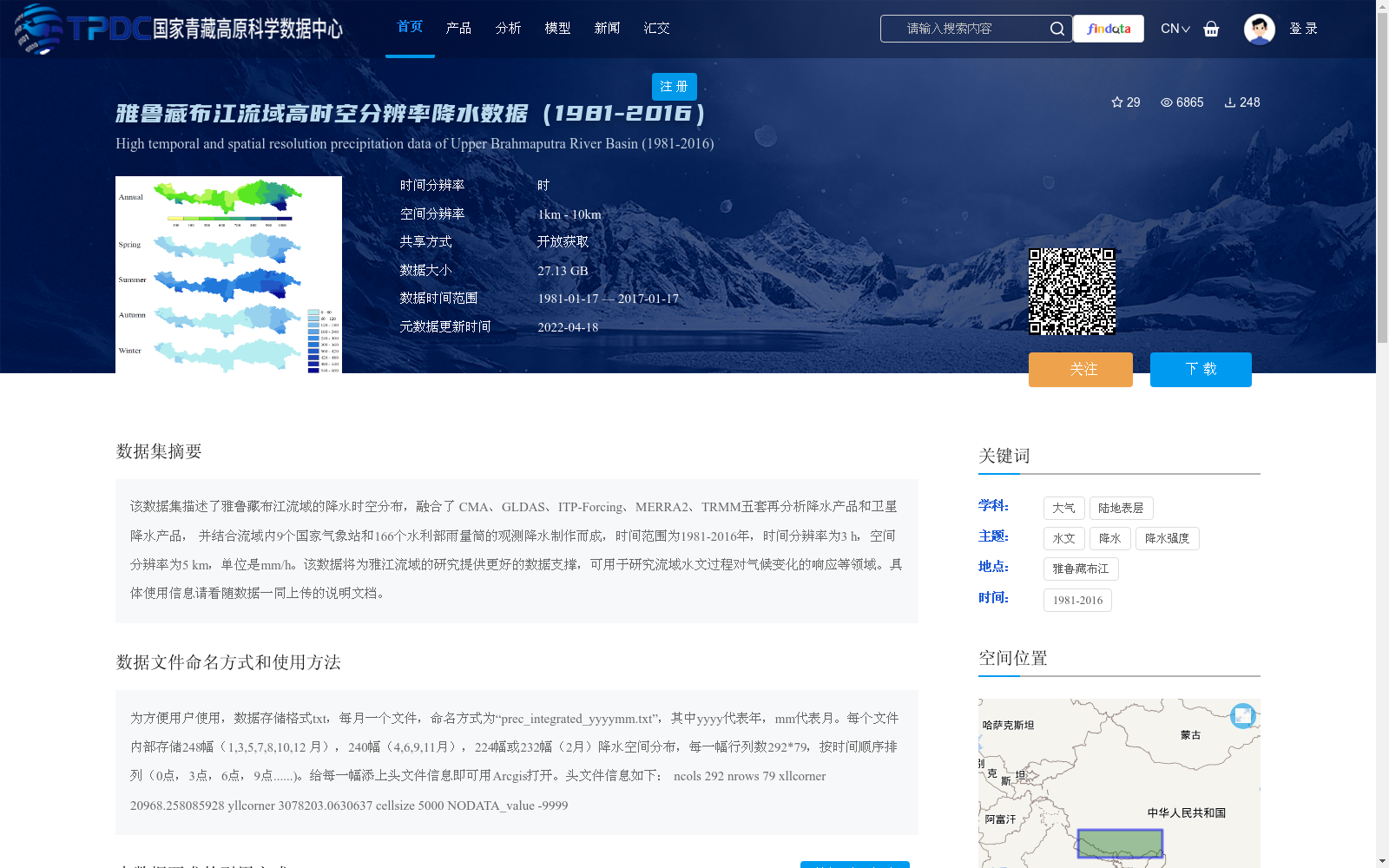
该数据集描述了雅鲁藏布江流域的降水时空分布,融合了 CMA、GLDAS、ITP-Forcing、MERRA2、TRMM五套再分析降水产品和卫星降水产品, 并结合流域内9个国家气象站和166个水利部雨量筒的观测降水制作而成,时间范围为1981-2016年,时间分辨率为3 h,空间分辨率为5 km,单位是mm/h。该数据将为雅江流域的研究提供更好的数据支撑,可用于研究流域水文过程对气候变化的响应等领域。具体使用信息请看随数据一同上传的说明文档。
This dataset describes the spatiotemporal distribution of precipitation over the Yarlung Zangbo River Basin. It incorporates five reanalysis precipitation products (CMA, GLDAS, ITP-Forcing, MERRA2, TRMM) and satellite precipitation products, and is developed using in-situ precipitation observations from 9 national meteorological stations and 166 rainfall gauges under the jurisdiction of the Ministry of Water Resources within the basin. The temporal coverage spans from 1981 to 2016, with a temporal resolution of 3 hours and a spatial resolution of 5 km, and the unit of measurement is mm/h. This dataset provides robust data support for research related to the Yarlung Zangbo River Basin, and can be applied in fields such as investigating the responses of basin hydrological processes to climate change. For specific usage information, please refer to the instruction document uploaded together with the dataset.
提供机构:
汪远伟,王磊,李秀萍,周璟
创建时间:
2020-02-01
搜集汇总
数据集介绍
背景与挑战
背景概述
该数据集是雅鲁藏布江流域1981-2016年的高时空分辨率降水数据,融合了多套再分析产品、卫星数据和地面观测站(包括9个气象站和166个雨量筒),时间分辨率为3小时,空间分辨率为5公里,数据格式为txt,每月一个文件,总大小27.13 GB。它旨在为流域水文过程对气候变化响应的研究提供精确数据支撑,适用于大气和陆地表层科学领域。
以上内容由遇见数据集搜集并总结生成


