松嫩平原地区10m分辨率土壤粉粒含量数据集(2020年)
收藏国家地球系统科学数据中心2024-11-27 更新2024-11-16 收录
下载链接:
https://www.geodata.cn/data/datadetails.html?dataguid=252418335129526&docId=2135
下载链接
链接失效反馈官方服务:
资源简介:
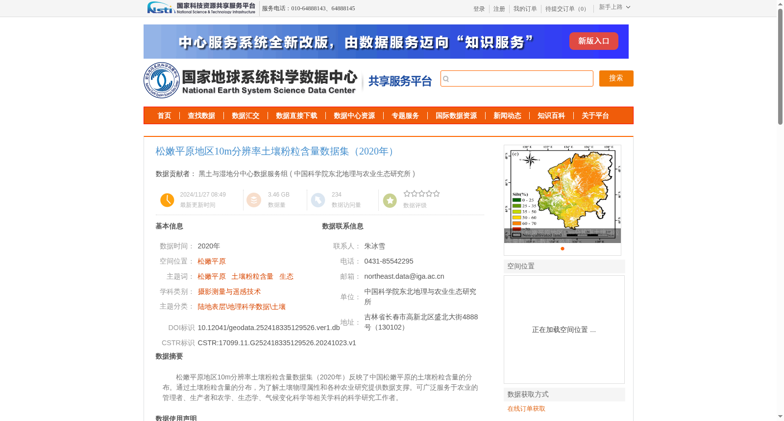
松嫩平原地区10m分辨率土壤粉粒含量数据集(2020年)反映了中国松嫩平原的土壤粉粒含量的分布。通过土壤粉粒含量的分布,为了解土壤物理属性和各种农业研究提供数据支撑。可广泛服务于农业的管理者、生产者和农学、生态学、气候变化科学等相关学科的科学研究工作者。
10m-resolution Soil Silt Content Dataset of Songnen Plain (2020) reflects the spatial distribution of soil silt content within the Songnen Plain of China. The dataset provides data support for understanding soil physical properties and carrying out various agricultural studies via the distribution of soil silt content. It can be widely served for agricultural managers, producers, and scientific researchers in relevant disciplines including agronomy, ecology, climate change science and other related fields.
提供机构:
中国科学院东北地理与农业生态研究所
创建时间:
2024-10-23
搜集汇总
数据集介绍
背景与挑战
背景概述
该数据集提供了2020年中国松嫩平原地区10米分辨率的土壤粉粒含量空间分布信息,基于Sentinel-2遥感影像,通过随机森林算法生成,决定系数为0.75,均方根误差为9.38%,精度较高。它旨在支持土壤物理属性研究和农业相关应用,服务于农业管理及生态学、气候变化等科学领域。
以上内容由遇见数据集搜集并总结生成


