喜马拉雅山脉30m数字高程模型(2006-2011)
收藏国家青藏高原科学数据中心2023-02-23 更新2024-04-21 收录
下载链接:
https://data.tpdc.ac.cn/zh-hans/data/4c0bc7b6-911f-4380-a9d7-90cd0738fefc
下载链接
链接失效反馈官方服务:
资源简介:
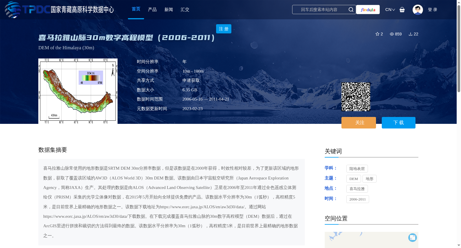
喜马拉雅山脉常使用的地形数据是SRTM DEM 30m分辨率数据,但是该数据是在2000年获得,时效性相对较差,为了更新该区域的地形数据,获取了覆盖该区域的AW3D(ALOS World 3D)30m DEM 数据。该数据由日本宇宙航空研究所(Japan Aerospace Exploration Agency,简称JAXA)生产。其处理的数据是由ALOS(Advanced Land Observing Satellite)卫星在2006年至2011年通过全色遥感立体测绘仪(PRISM)采集的光学立体像对数据,在2015年5月开始向全球提供免费的产品。该数据水平分辨率为30m(1弧秒),高程精度5米,是目前世界上最精确的地形数据之一。该数据下载地址为https://www.eorc.jaxa.jp/ALOS/en/aw3d30/data/。通过网站https://www.eorc.jaxa.jp/ALOS/en/aw3d30/data/下载数据。在下载完成覆盖喜马拉雅山脉的30m数字高程模型(DEM)数据后,通过在ArcGIS里进行拼接和裁切的方法得到最终的数据。该数据水平分辨率为30m(1弧秒),高程精度5米,是目前世界上最精确的地形数据之一。
The commonly used topographic data for the Himalayas is SRTM DEM with 30-meter resolution, which was acquired in 2000 and has relatively poor timeliness. To update the topographic data of this region, AW3D (ALOS World 3D) 30m DEM data covering the Himalayas was obtained. This dataset was produced by the Japan Aerospace Exploration Agency (JAXA). The raw data used for processing was optical stereo pair imagery collected by the ALOS (Advanced Land Observing Satellite) via its Panchromatic Remote-sensing Instrument for Stereo Mapping (PRISM) from 2006 to 2011, and free products of this dataset were made available globally starting in May 2015. This dataset has a horizontal resolution of 30 meters (1 arcsecond) and an elevation accuracy of 5 meters, making it one of the most accurate topographic datasets in the world currently. The download address of this dataset is https://www.eorc.jaxa.jp/ALOS/en/aw3d30/data/, and data can be downloaded through this website. After downloading the 30-meter digital elevation model (DEM) data covering the Himalayas, the final dataset is obtained via mosaicking and clipping operations in ArcGIS. This final dataset has a horizontal resolution of 30 meters (1 arcsecond) and an elevation accuracy of 5 meters, making it one of the most accurate topographic datasets in the world currently.
提供机构:
邱海军
创建时间:
2023-02-22
搜集汇总
数据集介绍
背景与挑战
背景概述
该数据集是喜马拉雅山脉30m数字高程模型(DEM),覆盖2006年至2011年,由日本宇宙航空研究所(JAXA)生产,基于ALOS卫星的PRISM传感器数据。数据具有30m水平分辨率和5m高程精度,是目前世界上最精确的地形数据之一,适用于高精度地形分析和研究。
以上内容由遇见数据集搜集并总结生成


