2000-2020年中国水旱田1km水分利用效率数据集
收藏资源简介:
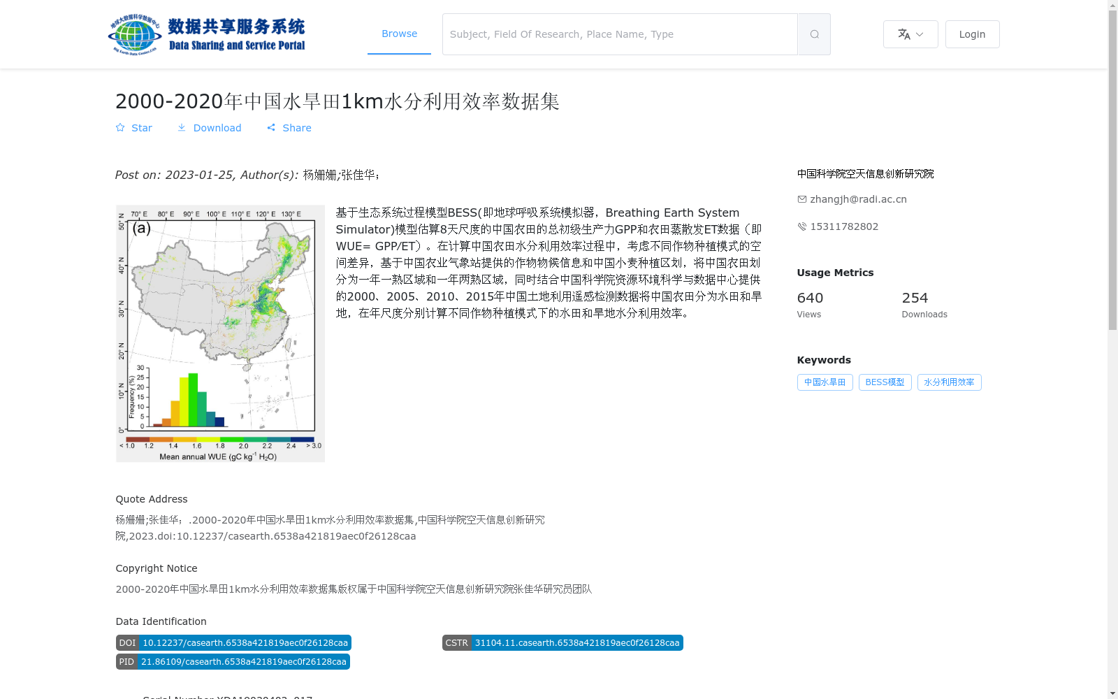
基于生态系统过程模型BESS(即地球呼吸系统模拟器,Breathing Earth System Simulator)模型估算8天尺度的中国农田的总初级生产力GPP和农田蒸散发ET数据(即WUE= GPP⁄ET)。在计算中国农田水分利用效率过程中,考虑不同作物种植模式的空间差异,基于中国农业气象站提供的作物物候信息和中国小麦种植区划,将中国农田划分为一年一熟区域和一年两熟区域,同时结合中国科学院资源环境科学与数据中心提供的2000、2005、2010、2015年中国土地利用遥感检测数据将中国农田分为水田和旱地,在年尺度分别计算不同作物种植模式下的水田和旱地水分利用效率。
This dataset estimates 8-day-scale gross primary productivity (GPP) and farmland evapotranspiration (ET) of croplands in China using the Breathing Earth System Simulator (BESS), an ecosystem process model also known as the Earth Respiratory System Simulator. Water use efficiency (WUE) is defined as WUE = GPP / ET. When calculating the WUE of croplands in China, spatial differences in crop planting patterns are taken into account. Based on crop phenology information provided by China Agricultural Meteorological Stations and China's wheat planting zoning, croplands in China are divided into single-cropping regions and double-cropping regions. Additionally, combined with remote sensing-based land use detection data of China in 2000, 2005, 2010 and 2015 provided by the Resources and Environmental Science and Data Center of the Chinese Academy of Sciences, croplands are further classified into paddy fields and drylands. The WUE of paddy fields and drylands under different crop planting patterns is respectively calculated at the annual scale.