一带一路沿线20国坡度坡长因子数据集
收藏国家地球系统科学数据中心2023-07-11 更新2024-03-04 收录
下载链接:
https://www.geodata.cn/data/datadetails.html?dataguid=118237295730381&docId=4639
下载链接
链接失效反馈官方服务:
资源简介:
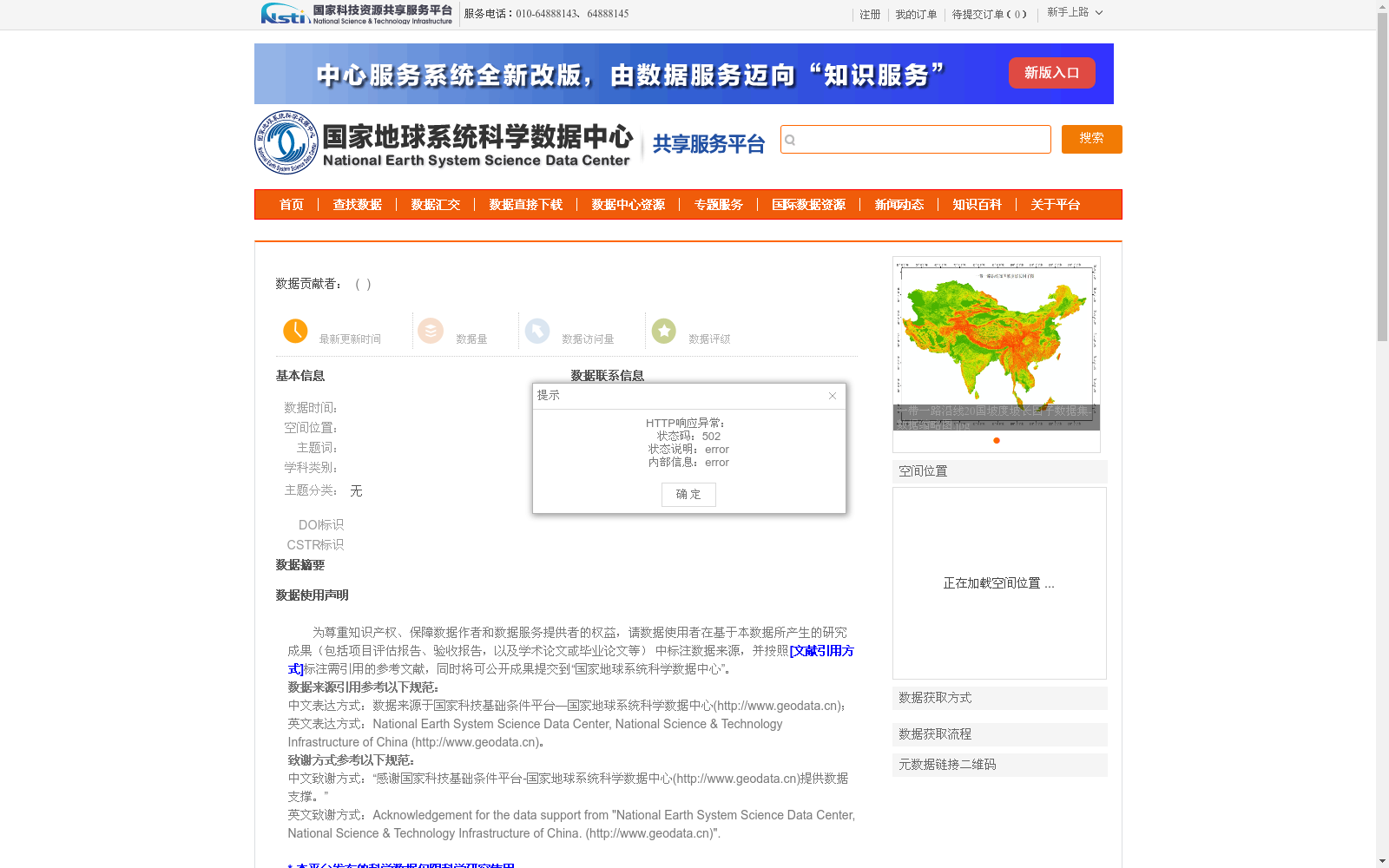
一带一路沿线20国坡度坡长因子(LS)数据集,基于公开的1弧秒分辨率SRTM数字高程数据(Shuttle Radar Topography Mission, SRTM;http://srtm.csi.cgiar.org),经过去接边、去除伪条纹等和滤波除噪等预处理,利用CSLE模型中的坡度坡长因子算法和本项目研发的坡度坡长因子计算工具(LS_Tool),计算得到7.5弧秒分辨率坡度坡长因子图。一带一路沿线20国坡度坡长因子数据,是基于CSLE进行土壤侵蚀速率计算的必备数据,同时分析泛一带一路沿线20国侵蚀地形特征(如高程、坡度、坡度等宏观分布和微观格局)的基础数据,对于该地区地貌特征、地质灾害特征的分析,也具有参考价值。
Slope Length and Steepness Factor (LS) Dataset for 20 Countries along the Belt and Road Initiative. This dataset is derived from publicly available 1-arcsecond resolution SRTM digital elevation data (Shuttle Radar Topography Mission, SRTM; http://srtm.csi.cgiar.org), and was preprocessed through steps including edge stitching removal, false stripe elimination, and filtering denoising. The 7.5-arcsecond resolution LS factor maps were generated using the LS factor algorithm from the Chinese Soil Loss Equation (CSLE) model and the LS_Tool developed in this project. The LS factor data for the 20 countries along the Belt and Road Initiative is a necessary dataset for calculating soil erosion rates based on CSLE, as well as a foundational dataset for analyzing eroded terrain characteristics (such as the macro-scale distribution and micro-scale patterns of elevation, slope, slope, etc.) of these countries. It also provides reference value for the analysis of geomorphic features and geological hazard characteristics in this region.
提供机构:
西北农林科技大学水土保持研究所,西北大学
创建时间:
2023-07-11
搜集汇总
数据集介绍
背景与挑战
背景概述
该数据集是基于1弧秒分辨率SRTM数字高程数据,经过预处理后利用CSLE模型和LS_Tool计算得到的7.5弧秒分辨率坡度坡长因子图,覆盖一带一路沿线20国,主要用于土壤侵蚀速率计算和侵蚀地形特征分析。
以上内容由遇见数据集搜集并总结生成


