青藏高原全区域1km冻融灾害危险性基础数据(2015)
收藏国家青藏高原科学数据中心2024-11-27 更新2024-12-07 收录
下载链接:
https://data.tpdc.ac.cn/zh-hans/data/21bbc51c-fac9-4f0c-bec0-09d0e88ffad6
下载链接
链接失效反馈官方服务:
资源简介:
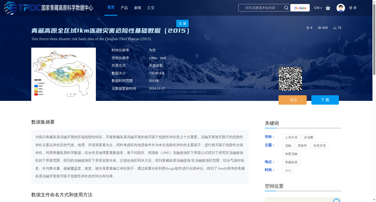
为揭示青藏高原冻融灾害的区域危险性特征,开展青藏高原冻融灾害的致灾因子危险性评价意义十分重要。冻融灾害致灾因子的危险性评价主要以评价区的气候、地理、环境等要素为主,同时考虑区内地质条件作为本次危险性评价的主要因子,进行致灾因子危险性分级评价。利用青藏高原科学数据,结合有关地理要素数据库,基于邱国庆、程国栋(1995)冻融侵蚀区下界面公式得到了研究区冻融侵蚀区的下界面范围,得到的冻融侵蚀区下界层去除水体、沙漠化地区和冰川后,得到青藏高原冻融侵蚀/非冻融侵蚀区范围,结合气温年较差、年均降水量、植被覆盖度、坡度、坡向等要素确立评价因子,通过权重分析利用Arcgis软件进行分级评估,得到了1km分辨率的青藏高原冻融灾害致灾因子危险性评价的空间分布结果。
To reveal the regional hazard characteristics of freeze-thaw disasters on the Qinghai-Tibet Plateau, it is of great significance to conduct a hazard assessment of the disaster-causing factors of such disasters. The hazard assessment of disaster-causing factors for freeze-thaw disasters primarily relies on climatic, geographic, environmental and other relevant factors of the study area, with geological conditions within the region also incorporated as core factors for the hierarchical hazard evaluation of disaster-causing factors. By utilizing scientific data from the Qinghai-Tibet Plateau and combining it with relevant geographic feature databases, the lower boundary range of freeze-thaw erosion zones in the study area was obtained based on the lower boundary formula for freeze-thaw erosion zones proposed by Qiu Guoqing and Cheng Guodong (1995). After removing water bodies, desertified areas and glaciers from the obtained lower boundary layer of freeze-thaw erosion zones, the scope of freeze-thaw erosion/non-freeze-thaw erosion zones on the Qinghai-Tibet Plateau was determined. Evaluation factors were established by combining elements such as annual temperature range, mean annual precipitation, vegetation coverage, slope and aspect. Hierarchical assessment was conducted using ArcGIS software through weight analysis, and the spatial distribution results of the hazard assessment of disaster-causing factors for freeze-thaw disasters on the Qinghai-Tibet Plateau with 1 km spatial resolution were obtained.
提供机构:
张国明
创建时间:
2024-11-26
搜集汇总
数据集介绍
背景与挑战
背景概述
该数据集提供了2015年青藏高原全区域1km分辨率的冻融灾害危险性评价结果,基于气候、地理、环境等要素进行危险性分级评价,适用于冻融灾害研究和风险评估。数据为栅格格式,可通过arcgis、envi等软件直接打开,共享方式为开放获取。
以上内容由遇见数据集搜集并总结生成


