青藏高原植被图(2050)
收藏国家青藏高原科学数据中心2025-05-27 更新2025-06-14 收录
下载链接:
https://data.tpdc.ac.cn/zh-hans/data/f99ae642-d418-4b40-9eba-9a97622d22a3
下载链接
链接失效反馈官方服务:
资源简介:
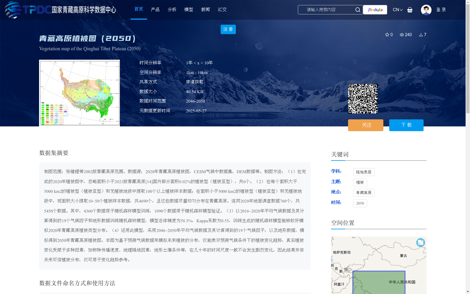
制图范围:张镱锂等2002版青藏高原范围。数据源:2020年青藏高原植被图,CESM气候中数据集,DEM数据等。制图方法:(1)在完成的2020年植被图中,忽略面积小于2021版青藏高原[14]国内部分面积0.02%的植被型(植被亚型),共6个。(2) 在每个面积大于5000 km2的植被型(植被亚型)和无植被地段中提取100个以上植被样本数据;在面积小于5000 km2的植被型(植被亚型)和无植被地段中,视面积大小提取10~50个植被样本数据,共4690个,且这些数据尽量均匀分布在青藏高原。连同2020年地面调查数据760个,共5450个数据。其中,4360个数据用于随机森林模型训练,1090个数据用于随机森林模型验证。(3)以2016~2020年平均气候数据及其计算得到的19个气候因子和地形数据训练随机森林模型,模型总体精度为58.5%,Kappa系数为0.55,训练生成的随机森林模型能够较好模拟2020年青藏高原植被类型分布。(4)运用此模型,采用2046~2050年平均气候数据及其计算得到的19个气候因子,以及地形数据,模拟得到2050年青藏高原植被图。本图为基于预测气候数据来模拟未来植被的分布,仅能表示预测气候条件下的植被变化趋势,真实植被变化受限于多种因素,如物种传播速度、地理隔绝因素,地形土壤条件等,在几十年的时间尺度一般不会发生剧烈变化,因此结果并非未来可信植被分布,仅可用于变化趋势参考。
Mapping Extent: The boundary of the Qinghai-Tibet Plateau defined by Zhang Yili et al. (2002). Data Sources: 2020 Qinghai-Tibet Plateau vegetation map, CESM climate dataset, DEM data, etc. Cartographic Methods: (1) In the finalized 2020 vegetation map, a total of 6 vegetation types (vegetation subtypes) with an area less than 0.02% of the area of the domestic segment of the Qinghai-Tibet Plateau in the 2021 version were excluded. (2) Extract more than 100 vegetation sample points from each vegetation type (vegetation subtype) and non-vegetation areas with an area greater than 5000 km²; For vegetation types (vegetation subtypes) and non-vegetation areas with an area smaller than 5000 km², extract 10 to 50 vegetation sample points based on their respective area, totaling 4690 samples, which are distributed as evenly as possible across the Qinghai-Tibet Plateau. Coupled with 760 ground survey sample points collected in 2020, the total number of data points reaches 5450. Among these, 4360 data points are used for Random Forest model training, and 1090 data points are used for Random Forest model validation. (3) Train a Random Forest model using the 2016–2020 average climate data, 19 climatic factors derived from these data, and topographic data. The overall accuracy of the model is 58.5%, and the Kappa coefficient is 0.55, indicating that the trained Random Forest model can effectively simulate the distribution of vegetation types on the Qinghai-Tibet Plateau in 2020. (4) Using this trained model, combined with the 2046–2050 average climate data, 19 derived climatic factors, and topographic data, simulate and generate the 2050 Qinghai-Tibet Plateau vegetation map. This map is developed to simulate future vegetation distribution based on projected climate data, and only represents the trend of vegetation change under the predicted climate conditions. Real vegetation changes are constrained by multiple factors, such as species dispersal rate, geographic isolation, topographic and soil conditions, etc., and generally do not undergo drastic changes on decadal timescales. Therefore, this result cannot be regarded as a credible future vegetation distribution, and can only be used as a reference for vegetation change trends.
提供机构:
周继华,郑元润,宋长青,程昌秀,高培超,沈石,叶思菁
创建时间:
2025-05-23
搜集汇总
数据集介绍
背景与挑战
背景概述
该数据集是2050年青藏高原植被预测图,基于随机森林模型和2046-2050年气候数据模拟生成,空间分辨率为1km-10km,主要用于研究未来植被变化趋势。数据以tiff格式存储,可通过地理信息系统软件打开使用。
以上内容由遇见数据集搜集并总结生成


