2020 年中国生态问题数据
收藏地球大数据科学工程2024-03-04 收录
下载链接:
https://data.casearth.cn/sdo/detail/653f5366819aec161b3b4687
下载链接
链接失效反馈官方服务:
资源简介:
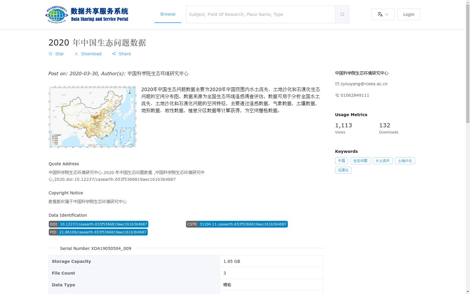
2020年中国生态问题数据主要为2020年中国范围内水土流失、土地沙化和石漠化生态问题的空间分布图,数据来源为全国生态环境遥感调查评估。数据可用于分析全国水土流失、土地沙化和石漠化问题的空间特征,主要通过遥感数据、气象数据、土壤数据、地形数据、岩性数据、植被分区数据等计算获得,为空间栅格数据。
The 2020 China Ecological Issues Dataset primarily contains spatial distribution maps of three major ecological issues in China during 2020: soil erosion, land desertification and rocky desertification. The dataset is derived from the national ecological environment remote sensing survey and assessment. It can be utilized to analyze the spatial characteristics of national-scale soil erosion, land desertification and rocky desertification problems. Generated through calculations based on diverse data sources including remote sensing data, meteorological data, soil data, topographic data, lithological data and vegetation regionalization data, this dataset is formatted as spatial raster data.
提供机构:
中国科学院生态环境研究中心
搜集汇总
数据集介绍
背景与挑战
背景概述
该数据集是2020年中国生态问题的空间分布数据,由中国科学院生态环境研究中心基于全国生态环境遥感调查评估发布,主要涵盖水土流失、土地沙化和石漠化三种生态问题。数据以栅格格式(.tif)提供,通过多源数据计算获得,适用于分析这些问题的空间分布特征和生态评估研究。
以上内容由遇见数据集搜集并总结生成


