丰宁县资源环境数据全县土地面积构成
收藏国家林业和草原科学数据中心2002-06-26 更新2024-03-06 收录
下载链接:
https://www.forestdata.cn/dataDetail.html?id=CSTR:17575.11.0120180626099.020001.V1
下载链接
链接失效反馈官方服务:
资源简介:
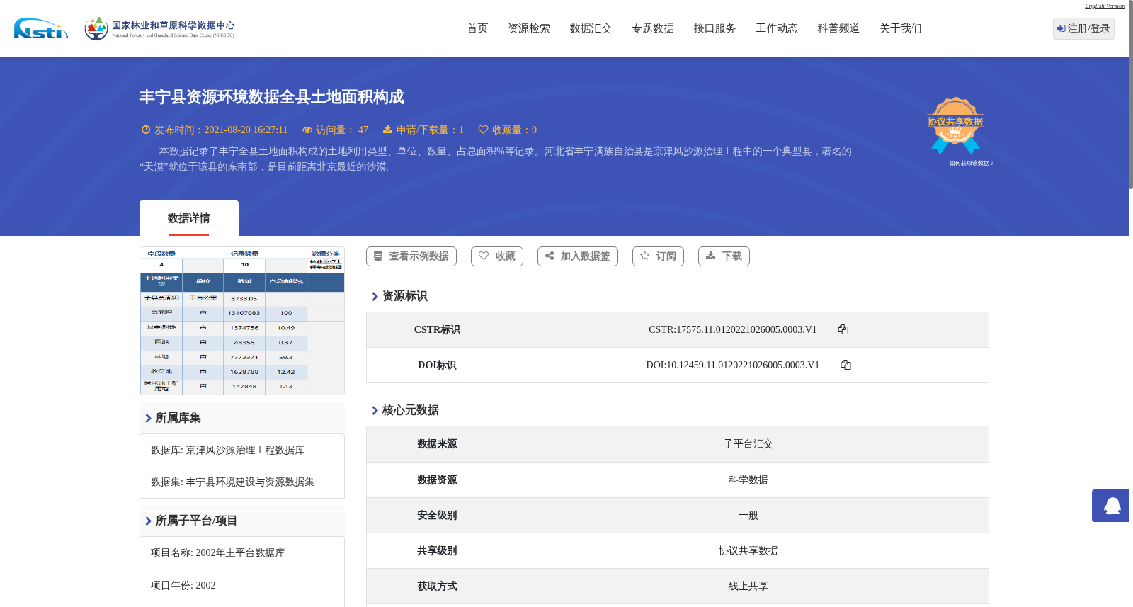
本数据记录了丰宁全县土地面积构成的土地利用类型、单位、数量、占总面积%等记录。河北省丰宁满族自治县是京津风沙源治理工程中的一个典型县,著名的“天漠”就位于该县的东南部,是目前距离北京最近的沙漠。
This dataset documents the land use types, measurement units, quantities, and their percentage shares relative to the total land area for all land area components of Fengning County. Fengning Manchu Autonomous County, Hebei Province, is a typical county in the Beijing-Tianjin Sandstorm Source Control Project. The famous "Tianmo Desert" is located in the southeastern part of this county, and it is currently the closest desert to Beijing.
提供机构:
国家林业和草原科学数据中心
创建时间:
2002-06-26
搜集汇总
数据集介绍
背景与挑战
背景概述
该数据集记录了2001年河北省丰宁满族自治县全县土地面积构成情况,包含土地利用类型、数量、占总面积百分比等统计信息。数据集属于京津风沙源治理工程数据库,以表格形式呈现,数据经过规范化加工处理,错误率低,旨在反映该典型县的资源环境状况。
以上内容由遇见数据集搜集并总结生成


