喜马拉雅地区危险性冰湖水深、湖泊水量数据
收藏国家青藏高原科学数据中心2025-04-22 更新2025-05-17 收录
下载链接:
https://data.tpdc.ac.cn/zh-hans/data/e8b25098-d024-4fcb-a592-ec4ee80c0c18
下载链接
链接失效反馈官方服务:
资源简介:
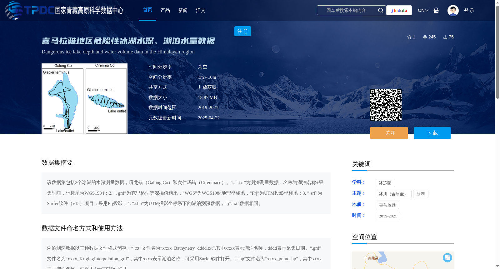
该数据集包括2个冰湖的水深测量数据,嘎龙错(Galong Co)和次仁玛错(Cirenmaco)。1. “.txt”为测深测量数据,名称为湖泊名称+采集时间,坐标系为WGS1984;2. ”. grd”为克里格法等深插值结果,“WGS”为WGS1984地理坐标系,“Prj”为UTM投影坐标系;3. ”.srf”为Surfer软件(v15)项目,采用Prj投影;4. “.shp”为UTM投影坐标系下的湖泊测深数据,与“.txt”数据相同。
This dataset contains bathymetric survey data for two glacial lakes: Galong Co and Cirenmaco.
1. Files with the .txt extension store bathymetric survey data, named in the format of [Lake Name] + [Collection Time], and utilize the WGS1984 coordinate system.
2. Files with the .grd extension are isobath interpolation results generated via the Kriging method. Here, 'WGS' denotes the WGS1984 geographic coordinate system, while 'Prj' refers to the UTM projected coordinate system.
3. Files with the .srf extension are Surfer (v15) software projects, which adopt the Prj projection.
4. Files with the .shp extension contain lake bathymetric data under the UTM projected coordinate system, which is consistent with the data in the .txt files.
提供机构:
张国庆
创建时间:
2025-04-21
搜集汇总
数据集介绍
背景与挑战
背景概述
该数据集包含喜马拉雅地区两个危险性冰湖(嘎龙错和次仁玛错)的水深和水量数据,数据格式多样,空间分辨率高(1m-10m),覆盖2019-2021年,可开放获取。
以上内容由遇见数据集搜集并总结生成


