自然资源高频次卫星遥感监测----国土变更调查监测产品
收藏海南省数据产品超市2023-07-24 更新2024-03-01 收录
下载链接:
https://www.datadex.cn/app/buyApi?id=e68370c188ec41e9a0aca557967508a8
下载链接
链接失效反馈官方服务:
资源简介:
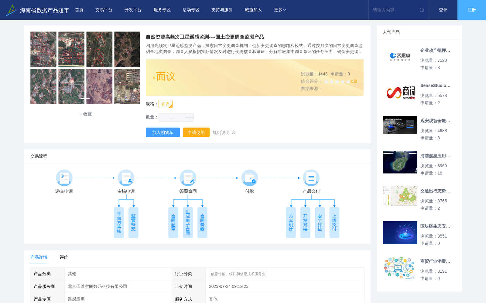
利用高频次卫星遥感监测产品,探索日常变更调查机制,创新变更调查的思路和模式。通过按月度的日常变更调查监测全地类图斑,调查人员根据实际情况及时进行变更核查和举证,分解年底集中调查举证的任务压力,确保变更调查地类的准确性和可靠度;实现“多监合一、一监多用”;针对违法用地实现“早发现、早制止”。
在常态化监测的基础上,增加全要素变化监测,按需利用高分辨率遥感影像,增加监测频次,满足国土变更调查要求。
Leveraging high-frequency satellite remote sensing monitoring products, this work explores the daily land change survey mechanism and innovates the ideas and models of change surveys. By monitoring all land-type patches via monthly routine change surveys, surveyors can conduct timely change verification and proof submission based on on-site actual conditions, thereby alleviating the task pressure of centralized investigation and proof submission at the end of the year, and ensuring the accuracy and reliability of land types in change surveys. This achieves the goal of "integrating multiple monitoring functions and realizing one monitoring for multiple purposes", and enables "early detection and early cessation" for illegal land use.
On the basis of regular monitoring, full-factor change monitoring is added, and high-resolution remote sensing images are utilized as needed to increase monitoring frequency, so as to meet the requirements of national land change surveys.
提供机构:
北京四维空间数码科技有限公司
创建时间:
2023-07-24
搜集汇总
数据集介绍
背景与挑战
背景概述
该数据集通过高频次卫星遥感监测实现月度全地类图斑变更调查,提供三个层级的监测产品(2米级新增建设用地监测、全要素变化监测及亚米级补充监测),支持'多监合一'机制和违法用地早期发现,有效分解年度调查压力并提升执法效率。
以上内容由遇见数据集搜集并总结生成


