南极Amery冰架流速场数据集V1.0(2003-2013)
收藏地球大数据科学工程2024-03-04 收录
下载链接:
https://data.casearth.cn/sdo/detail/65432c9c819aec3beb1bbf84
下载链接
链接失效反馈官方服务:
资源简介:
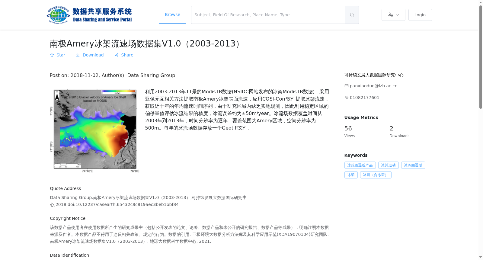
利用2003-2013年11景的Modis1B数据(NSIDC网站发布的冰架Modis1B数据),采用亚像元互相关方法提取南极Amery冰架表面流速,应用COSI-Corr软件提取冰架流速,获取近十年的年均流速时间序列,由于研究区域内缺乏实地观测,因此利用稳定区域的偏移量值评估冰流结果的精度,冰流误差约为±50m/year。冰流场数据覆盖时间从2003年到2013年,时间分辨率为逐年,覆盖范围为Amery区域,空间分辨率为500m。每年的冰流场数据存放一个Geotiff文件。
Using 11 scenes of MODIS 1B data (ice shelf MODIS 1B data released on the NSIDC website) from 2003 to 2013, the surface flow velocity of the Antarctic Amery Ice Shelf was extracted via the sub-pixel cross-correlation method, and the ice shelf flow velocity was retrieved using the COSI-Corr software. Annual mean flow velocity time series spanning 2003 to 2013 were obtained. Given the lack of in-situ observations within the study area, the accuracy of the ice flow results was evaluated using offset values from stable regions, with an ice flow error of approximately ±50 m/year. The ice flow field dataset covers the period from 2003 to 2013, with a yearly temporal resolution, spans the Amery Ice Shelf region, and has a spatial resolution of 500 m. Each year’s ice flow field data is stored as a single Geotiff file.
提供机构:
可持续发展大数据国际研究中心
搜集汇总
数据集介绍
背景与挑战
背景概述
该数据集提供了2003年至2013年南极Amery冰架的年均流速时间序列,空间分辨率为500m,数据格式为Geotiff。通过Modis1B数据提取流速,误差约为±50m/year,适用于冰冻圈遥感研究。
以上内容由遇见数据集搜集并总结生成


