30米全球地表覆盖数据
收藏CnOpenData2024-05-23 收录
下载链接:
https://www.cnopendata.com/data/m/public/china-globeLand30.html
下载链接
链接失效反馈官方服务:
资源简介:
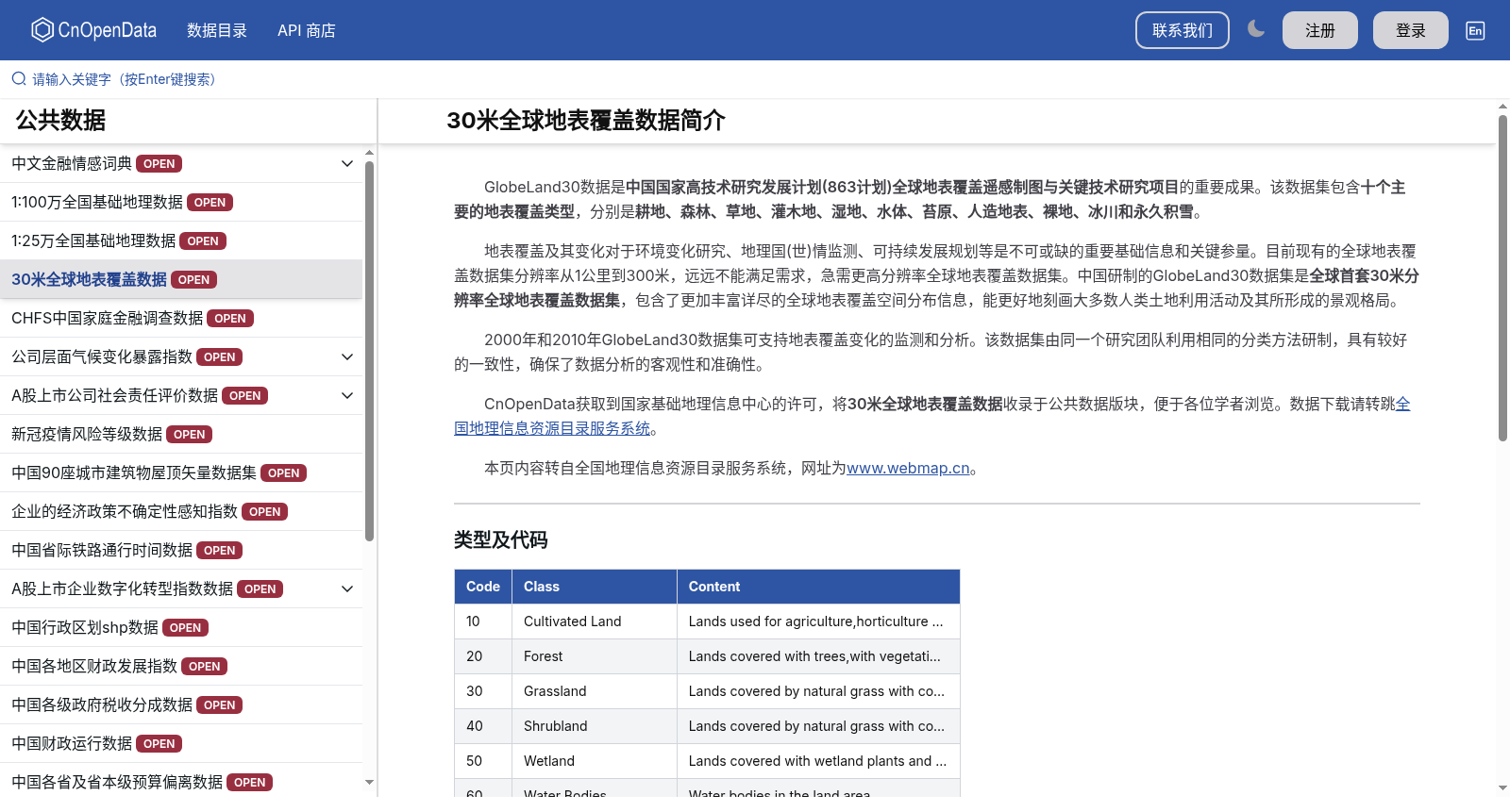
GlobeLand30数据是中国国家高技术研究发展计划(863计划)全球地表覆盖遥感制图与关键技术研究项目的重要成果。该数据集包含十个主要的地表覆盖类型,分别是耕地、森林、草地、灌木地、湿地、水体、苔原、人造地表、裸地、冰川和永久积雪。 地表覆盖及其变化对于环境变化研究、地理国(世)情监测、可持续发展规划等是不可或缺的重要基础信息和关键参量。目前现有的全球地表覆盖数据集分辨率从1公里到300米,远远不能满足需求,急需更高分辨率全球地表覆盖数据集。中国研制的GlobeLand30数据集是全球首套30米分辨率全球地表覆盖数据集,包含了更加丰富详尽的全球地表覆盖空间分布信息,能更好地刻画大多数人类土地利用活动及其所形成的景观格局。
GlobeLand30 is a key achievement of the Research Project on Global Land Cover Remote Sensing Mapping and Key Technologies under the National High-Tech Research and Development Program of China (863 Program). This dataset includes ten major land cover types, namely cropland, forest, grassland, shrubland, wetland, water bodies, tundra, artificial surfaces, bare land, glaciers and permanent snow cover.
Land cover and its changes are indispensable fundamental information and key parameters for environmental change research, national (global) geographical condition monitoring, sustainable development planning and other related fields. Currently, existing global land cover datasets have resolutions ranging from 1 km to 300 m, which are far from meeting the actual demand, and there is an urgent need for higher-resolution global land cover datasets. The GlobeLand30 dataset developed by China is the world's first global land cover dataset with a 30-meter resolution. It contains more abundant and detailed spatial distribution information of global land cover, and can better characterize most human land use activities and the landscape patterns formed by these activities.
提供机构:
CnOpenData
搜集汇总
数据集介绍
背景与挑战
背景概述
30米全球地表覆盖数据是中国863计划的重要成果,是全球首套30米分辨率的全球地表覆盖数据集,包含耕地、森林等十个主要类型。该数据集支持2000年和2010年的变化监测,并提供详细的地理统计信息,如森林占全球地表面积的28.54%,广泛应用于气候变化研究和可持续发展规划。
以上内容由遇见数据集搜集并总结生成


