大喜马拉雅地区冰湖编目数据集(1990-2020)
收藏国家青藏高原科学数据中心2023-04-07 更新2024-03-01 收录
下载链接:
https://data.tpdc.ac.cn/zh-hans/data/abf9d159-2b8b-457b-81cc-68ead854eae0
下载链接
链接失效反馈官方服务:
资源简介:
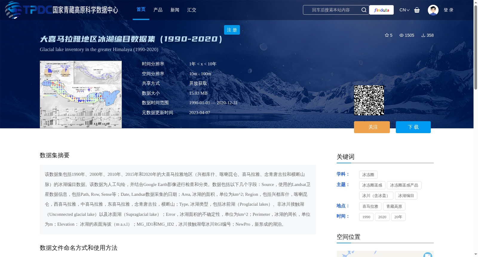
该数据集包括1990年、2000年、2010年、2015年和2020年的大喜马拉雅地区(兴都库什、喀喇昆仑、喜马拉雅、念青唐古拉和横断山脉)的冰湖编目数据。该数据为人工勾绘,并结合Google Earth影像进行检查和分类。数据包括以下几个字段:Source,使用的Landsat卫星数据信息,包括Path, Row, Sense等;Date, Landsat数据采集的日期;Area, 冰湖的面积,单位为km^2; Region,包括兴都库什,喀喇昆仑,西喜马拉雅,中喜马拉雅,东喜马拉雅,念青唐古拉,横断山;Type, 冰湖类型,包括冰前湖(Proglacial lakes)、非冰川接触湖(Unconnected glacial lake)以及冰面湖(Supraglacial lake);Error,冰湖面积的不确定性,单位为km^2;Perimeter,冰湖的周长,单位为m;Elevation: 冰湖的表面海拔(m a.s.l);MG_ID1和MG_ID2,冰川接触湖母冰川RGI编号;NewPro,新形成的湖泊。
This dataset contains glacial lake inventories for the Greater Himalaya region (including Hindu Kush, Karakoram, Himalaya, Nyainqêntanglha, and Hengduan Mountains) for the years 1990, 2000, 2010, 2015, and 2020.
The data was manually delineated, verified and classified using Google Earth imagery. The dataset includes the following attributes:
- Source: Details of the used Landsat satellite data, including Path, Row, Sense, and other related parameters;
- Date: The acquisition date of the Landsat imagery;
- Area: The surface area of the glacial lake, with the unit of km²;
- Region: The geographical sub-region, including Hindu Kush, Karakoram, Western Himalaya, Central Himalaya, Eastern Himalaya, Nyainqêntanglha, and Hengduan Mountains;
- Type: The category of the glacial lake, including proglacial lakes, unconnected glacial lakes, and supraglacial lakes;
- Error: The uncertainty associated with the measured glacial lake area, with the unit of km²;
- Perimeter: The perimeter of the glacial lake, with the unit of m;
- Elevation: The surface elevation of the glacial lake (m a.s.l.);
- MG_ID1 and MG_ID2: The RGI identification numbers of the parent glaciers for glacially connected lakes;
- NewPro: Indicator for newly formed glacial lakes.
提供机构:
王蒙蒙,张国庆
创建时间:
2023-04-07
搜集汇总
数据集介绍
背景与挑战
背景概述
该数据集包含1990-2020年大喜马拉雅地区的冰湖编目数据,覆盖兴都库什、喀喇昆仑、喜马拉雅等区域,数据为人工勾绘并结合Google Earth影像检查,包含冰湖面积、类型、海拔等详细信息。数据格式为ESRI Shapefile,适用于ArcGIS或QGIS软件使用。
以上内容由遇见数据集搜集并总结生成


