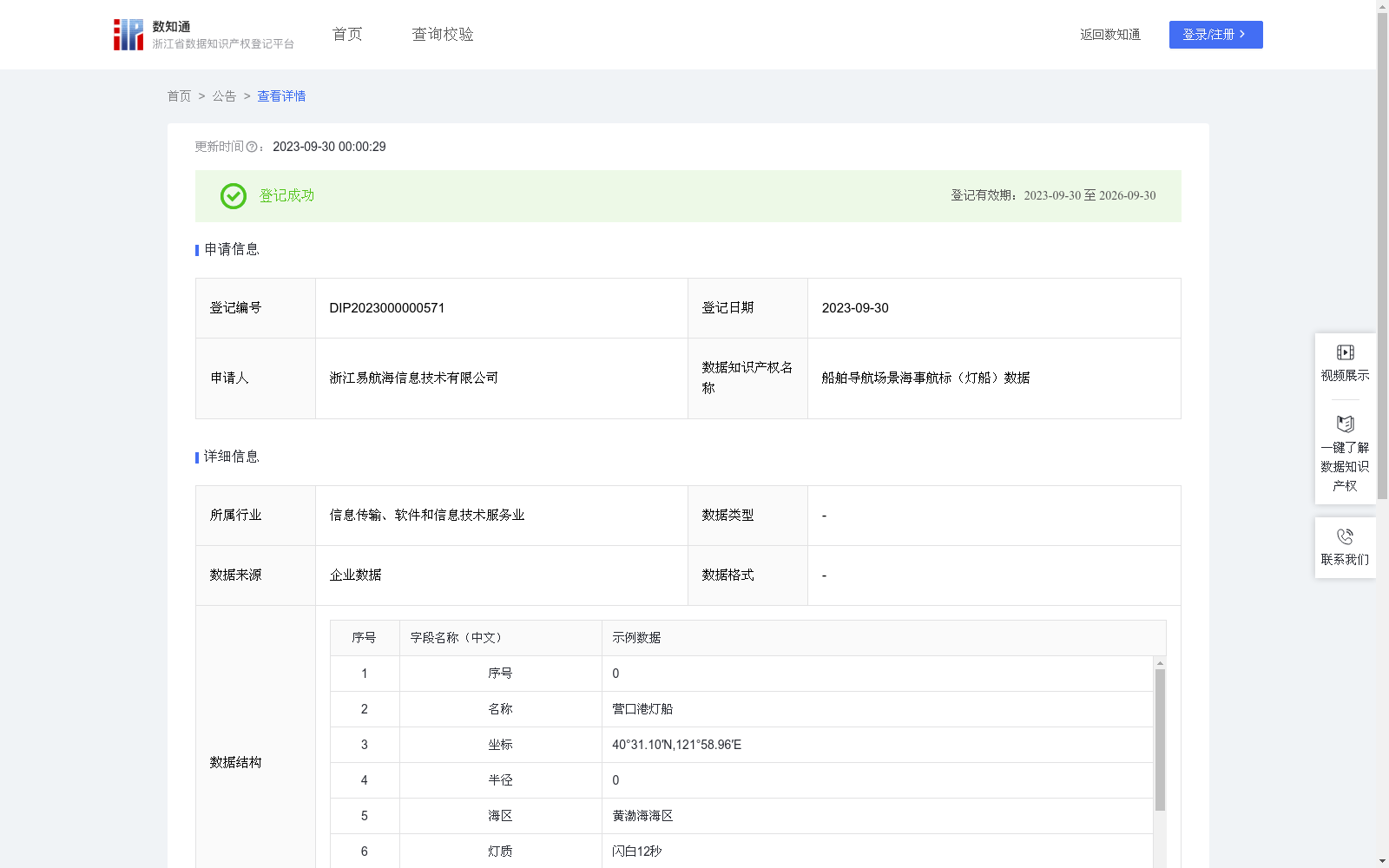
船舶导航场景海事航标(灯船)数据
收藏浙江省数据知识产权登记平台2023-09-30 更新2024-05-08 收录
下载链接:
https://www.zjip.org.cn/home/announce/trends/3942
下载链接
链接失效反馈官方服务:
资源简介:
船舶导航应用中,用户可根据其当前经纬度位置来查找所处海区的所有灯船数据,可以帮助用户进行航线规划,确定船舶位置和航向,使船舶沿航道和预定航线安全航行,保障船舶航行安全。灯船数据中的坐标和半径为geom数据,主要对geom数据进行加工处理,数据存储为WKT格式,一部分描述空间几何对象的类型和坐标系信息(例:LINESTRING (x1 y1, x2 y2, ..., xn yn)),另一部分则是空间几何对象的坐标点的序列,系统通过坐标类型的枚举匹配识别出当前WKT的对象类型,然后根据对象类型对其包含的空间信息进行二次处理,根据点、线、面、多线、多面等情况进行处理后生成经纬度列表数据list,根据射线法判断两个面是否相交,射线法主要思想是从一个点(通常是多边形的重心)发出一条射线,然后计算这条射线穿过多边形的边数。如果穿过的边数为奇数,则这个点在多边形内部;反之则在多边形外部。最后将list划分至对应的海区,船舶在导航过程中,根据其当前经纬度位置来判断所处海区,并将海区中所有的海事航标在海图上显示。
In ship navigation applications, users can retrieve all light vessel data within their current sea area based on their real-time latitude and longitude coordinates. This functionality supports route planning, vessel position and course confirmation, enables safe navigation along waterways and pre-planned routes, and ultimately safeguards maritime navigation safety.
The coordinates and radius included in light vessel data belong to geom data, and the core processing target is such geom data, which is stored in Well-Known Text (WKT) format. A WKT string contains two parts: one part describes the type of spatial geometric object and coordinate system information (e.g., "LINESTRING (x1 y1, x2 y2, ..., xn yn)"), while the other part comprises the sequence of coordinate points of the spatial geometric object. The system first identifies the object type of the current WKT string via enumeration matching of coordinate types, then conducts secondary processing on the contained spatial information. After processing cases such as points, lines, polygons, multi-lines and multi-polygons, a latitude-longitude list dataset is generated.
The ray-casting algorithm is adopted to judge whether two polygons intersect. The core idea of this algorithm is to emit a ray from a reference point (usually the centroid of a polygon), then count the number of polygon edges crossed by the ray. If the number of crossed edges is odd, the reference point lies inside the polygon; otherwise, it is outside the polygon.
Finally, the generated latitude-longitude list is categorized into corresponding sea areas. During the navigation process, the vessel determines its current sea area based on its real-time latitude and longitude coordinates, and displays all maritime aids to navigation in the identified sea area on the nautical chart.
提供机构:
浙江易航海信息技术有限公司
创建时间:
2023-08-31
搜集汇总
数据集介绍
特点
该数据集包含20条海事航标(灯船)数据,每周更新,适用于船舶导航应用。数据包括航标名称、坐标、灯质、灯高等详细信息,帮助用户进行航线规划和航行安全。数据来源于浙江易航海信息技术有限公司,已通过浙江省知识产权区块链公共存证平台存证。
以上内容由遇见数据集搜集并总结生成


