全国1:1000万土壤类型分布图(中国土壤发生分类系统)(1981年)
收藏国家地球系统科学数据中心2022-03-15 更新2024-03-04 收录
下载链接:
https://www.geodata.cn/data/datadetails.html?dataguid=118008575895165&docId=9748
下载链接
链接失效反馈官方服务:
资源简介:
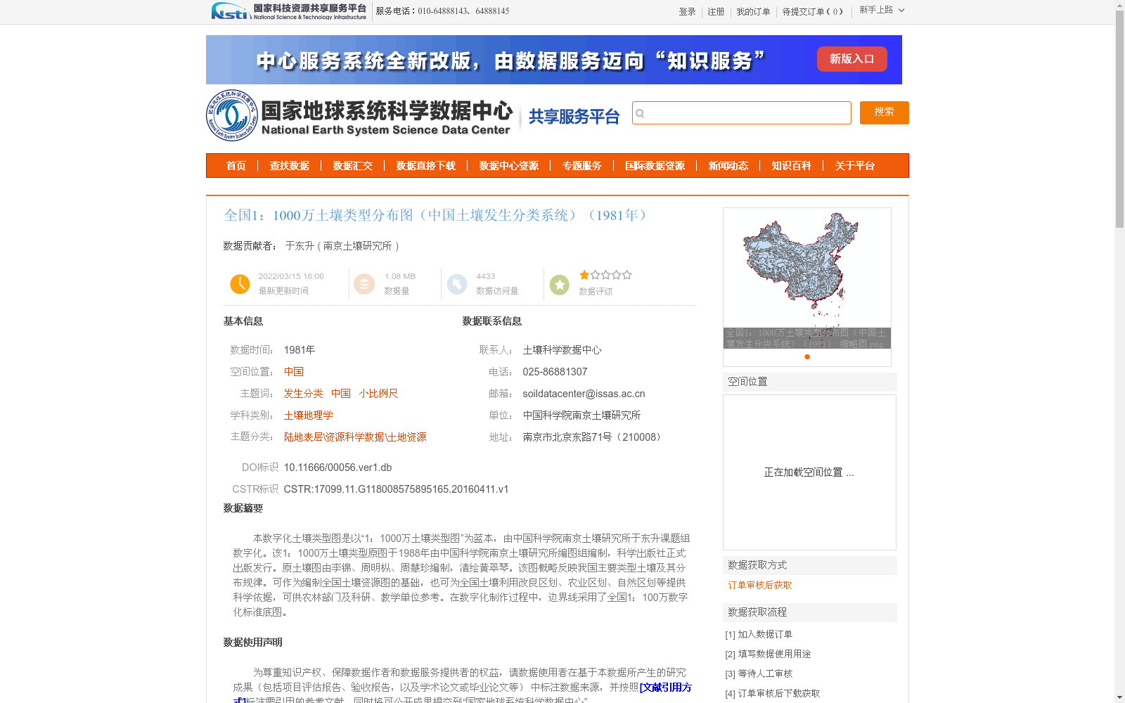
本数字化土壤类型图是以“1:1000万土壤类型图”为蓝本,由中国科学院南京土壤研究所于东升课题组数字化。该1:1000万土壤类型原图于1988年由中国科学院南京土壤研究所编图组编制,科学出版社正式出版发行。原土壤图由李锦、周明枞、周慧珍编制,清绘黄翠琴。该图概略反映我国主要类型土壤及其分布规律。可作为编制全国土壤资源图的基础,也可为全国土壤利用改良区划、农业区划、自然区划等提供科学依据,可供农林部门及科研、教学单位参考。在数字化制作过程中,边界线采用了全国1:100万数字化标准底图。
This digital soil type map is based on the "1:10,000,000 Soil Type Map", and was digitized by the research group led by Yu Dongsheng from the Institute of Soil Science, Nanjing, Chinese Academy of Sciences. The original 1:10,000,000 Soil Type Map was compiled by the Mapping Team of the Institute of Soil Science, Nanjing, Chinese Academy of Sciences in 1988, and officially published by Science Press. The original soil map was drafted by Li Jin, Zhou Mingcong and Zhou Huizhen, with final cartographic artwork completed by Huang Cuiqin. This map generally reflects the major soil types in China and their distribution patterns. It can serve as a foundation for compiling national soil resource maps, provide scientific basis for national soil utilization and improvement zoning, agricultural zoning, natural zoning and other related work, and can be used as a reference by agricultural and forestry departments, research institutions and educational institutions. During the digitization process, the national 1:1,000,000 digital standard base map was adopted for the boundary lines.
提供机构:
南京土壤研究所
创建时间:
2016-04-11
搜集汇总
数据集介绍
背景与挑战
背景概述
该数据集是基于1981年中国土壤发生分类系统的全国1:1000万土壤类型分布数字化图,由中国科学院南京土壤研究所于东升课题组以1988年出版的原始图为蓝本制作,概略反映了中国主要土壤类型及其分布规律。数据采用Arcgis工具数字化,空间投影为Albers,适用于土壤资源图编制、农业区划和科研教学参考。
以上内容由遇见数据集搜集并总结生成


