青藏公路沿线热融湖塘分布数据(1991-2020)
收藏国家青藏高原科学数据中心2023-08-18 更新2024-03-06 收录
下载链接:
https://data.tpdc.ac.cn/zh-hans/data/5e984981-b3f3-412d-8801-49dc0c00c6d0
下载链接
链接失效反馈官方服务:
资源简介:
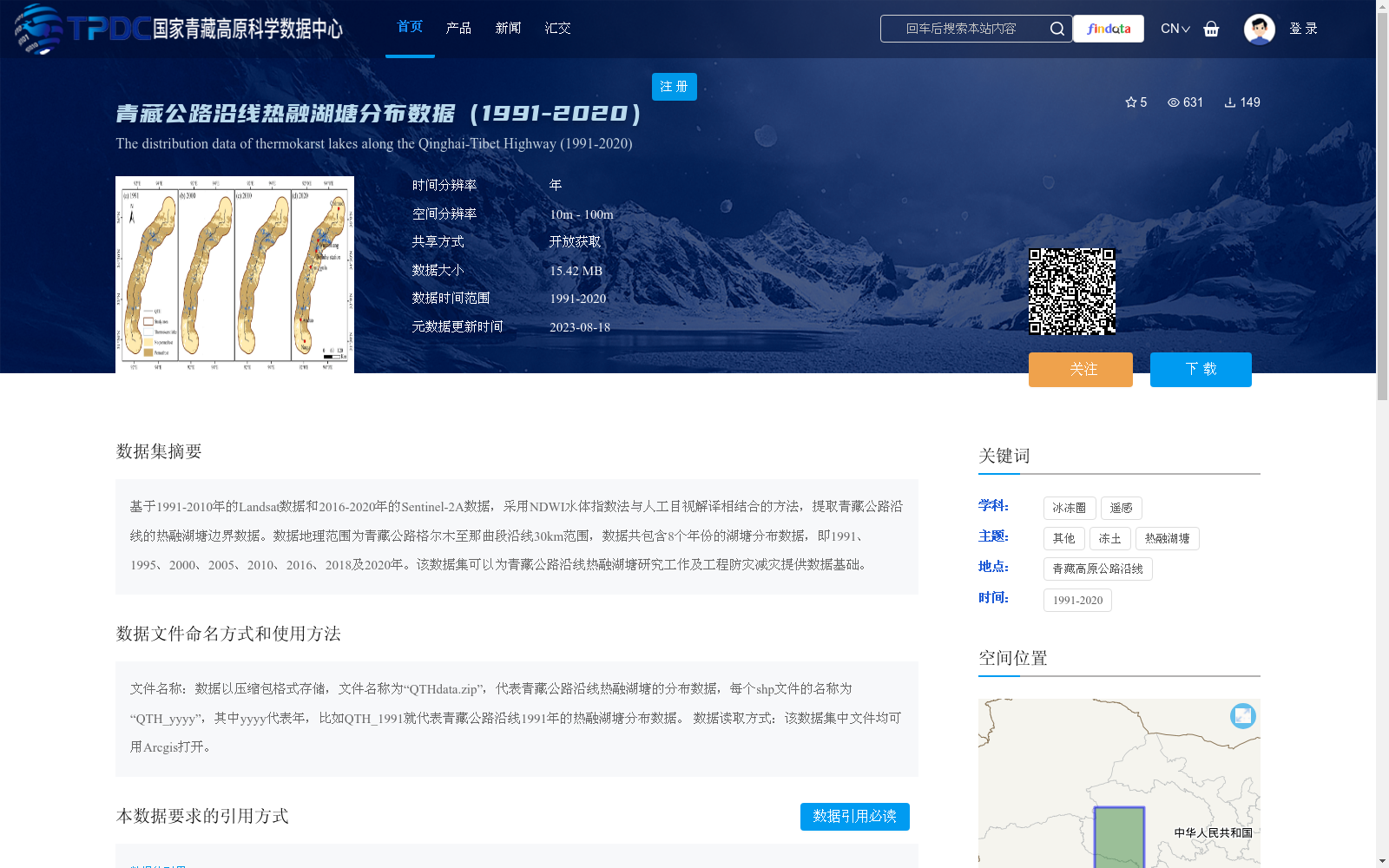
基于1991-2010年的Landsat数据和2016-2020年的Sentinel-2A数据,采用NDWI水体指数法与人工目视解译相结合的方法,提取青藏公路沿线的热融湖塘边界数据。数据地理范围为青藏公路格尔木至那曲段沿线30km范围,数据共包含8个年份的湖塘分布数据,即1991、1995、2000、2005、2010、2016、2018及2020年。该数据集可以为青藏公路沿线热融湖塘研究工作及工程防灾减灾提供数据基础。
This dataset extracts the boundary data of thermokarst lakes along the Qinghai-Tibet Highway by combining the NDWI water index method and manual visual interpretation, using Landsat data from 1991 to 2010 and Sentinel-2A data from 2016 to 2020. The geographic coverage of the dataset is a 30-kilometer buffer zone along the Golmud to Nagqu section of the Qinghai-Tibet Highway. It contains lake distribution data for 8 specific years: 1991, 1995, 2000, 2005, 2010, 2016, 2018 and 2020. This dataset can provide a fundamental data foundation for research on thermokarst lakes along the Qinghai-Tibet Highway as well as engineering disaster prevention and mitigation.
提供机构:
母梅,牟翠翠,陈旭
创建时间:
2023-08-17
搜集汇总
数据集介绍
背景与挑战
背景概述
该数据集提供了1991-2020年间青藏公路沿线热融湖塘的分布数据,基于Landsat和Sentinel-2A数据,采用NDWI水体指数法与人工目视解译相结合的方法提取,包含8个年份的数据,空间分辨率为10m - 100m,旨在为热融湖塘研究及工程防灾减灾提供数据基础。
以上内容由遇见数据集搜集并总结生成


