广东海岸带森林资源分布图(1:150万)
收藏南海海洋数据中心2024-03-01 收录
下载链接:
https://data.scsio.ac.cn/metaData-detail/1503943961481760768
下载链接
链接失效反馈官方服务:
资源简介:
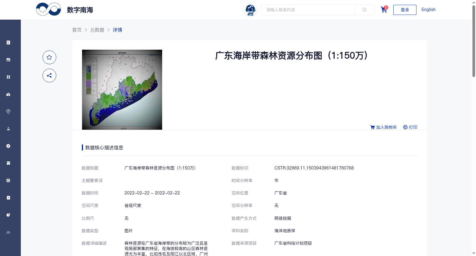
森林资源在广东省海岸带的分布较为广泛且呈现局部聚集的特征,在海拔较高的山区森林资源尤为丰富,比如茂名及阳江以北区域、广州市东北部向河源延伸区域、汕尾市北部等。珠江口近岸森林覆盖率较小,此处主要为工业和城镇建设用地。湛江至茂名之间森林面积较少,此处植被多为农作物。
Forest resources are widely distributed along the coastal zone of Guangdong Province and exhibit the characteristics of local aggregation. They are particularly abundant in high-altitude mountainous areas, such as the regions north of Maoming and Yangjiang, the area extending from the northeast of Guangzhou to Heyuan, and the northern part of Shanwei City. The nearshore areas of the Pearl River Estuary have a relatively low forest coverage rate, where the land is mainly used for industrial and urban construction purposes. The area between Zhanjiang and Maoming has a relatively small forest area, where the vegetation is mostly crops.
提供机构:
广州海洋地质调查局
搜集汇总
数据集介绍
背景与挑战
背景概述
该数据集为广东省海岸带森林资源分布地图,比例为1:150万,数据时间为2022年2月22日,属于省级尺度图片数据,学科类别为海洋地质学。数据集通过网络挖掘整合生产,质量可靠,显示森林资源在广东海岸带分布广泛且局部聚集,山区如茂名、阳江以北区域森林丰富,而珠江口近岸和湛江至茂名之间森林覆盖率较低,主要用于工业和农业用地。
以上内容由遇见数据集搜集并总结生成


