青海乡土牧草种植适宜性区划数据集(2021)
收藏国家青藏高原科学数据中心2022-06-15 更新2024-03-06 收录
下载链接:
https://data.tpdc.ac.cn/zh-hans/data/009c16c0-e9ee-488e-97e3-2113f67593a3
下载链接
链接失效反馈官方服务:
资源简介:
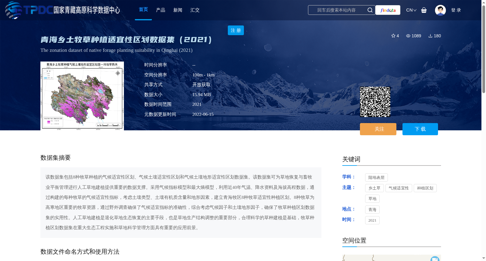
该数据集包括8种牧草种植的气候适宜性区划、气候土壤适宜性区划和气候土壤地形适宜性区划数据集。该数据集可为草地恢复与畜牧业平衡管理进行人工草地建植提供重要的数据支撑。采用气候指标模型和最大熵模型,利用近40年气温、降水资料及海拔高程数据,通过构建的每种牧草的气候适宜性指标,考虑土壤类型、土壤有机质含量和地形因素,建立青海牧区8种牧草适宜性种植区划。8种牧草为高寒地区重要的牧草资源,通过野外调查确保了气候适宜指标的准确性,综合考虑气候因子和土壤地形因子,确保了牧草种植区划数据集的实用性。人工草地建植是退化草地生态恢复的主要手段,也是草地生产结构调整的重要部分,合理科学的草种建植是基础,牧草种植区划数据集在重大生态工程实施和草地科学管理方面具有重要的应用前景。
This dataset includes three types of planting suitability zoning datasets for 8 forage grasses: climatic suitability zoning, climatic-soil suitability zoning, and climatic-soil-topographic suitability zoning. This dataset offers critical data support for establishing artificial grasslands to support balanced grassland restoration and livestock husbandry management.
It adopts climatic index models and the Maximum Entropy Model, leveraging nearly 40 years of temperature, precipitation and elevation data. By establishing climatic suitability indicators for each forage grass and considering soil type, soil organic matter content and topographic factors, it develops suitable planting zoning for the 8 forage grasses in the Qinghai pastoral area.
The 8 forage grasses are important forage resources in alpine regions. The accuracy of the climatic suitability indicators was verified through field surveys, and the comprehensive consideration of climatic, soil and topographic factors ensures the practicality of this forage planting zoning dataset.
The establishment of artificial grasslands is a primary approach for restoring degraded grassland ecosystems and an important component of adjusting grassland production structures. Rational and scientific grass species selection and establishment serve as the foundation. This forage planting zoning dataset holds significant application prospects in the implementation of major ecological projects and scientific grassland management.
提供机构:
周华坤,苏文将,周秉荣,石明明,赵慧芳
创建时间:
2022-05-14
搜集汇总
数据集介绍
背景与挑战
背景概述
该数据集是2021年青海省乡土牧草种植适宜性区划数据,包括8种高寒地区重要牧草(如冷地早熟禾、垂穗披碱草等)的气候、气候土壤和气候土壤地形三种适宜性区划,空间分辨率为100米至1公里。数据集基于近40年气候数据和土壤地形因子,采用气候指标模型和最大熵模型构建,旨在为草地生态恢复和人工草地建植提供科学支撑,适用于重大生态工程和草地管理应用。
以上内容由遇见数据集搜集并总结生成


