青藏高原多年冻土地温与热稳定型分布图(2005-2015)
收藏资源简介:
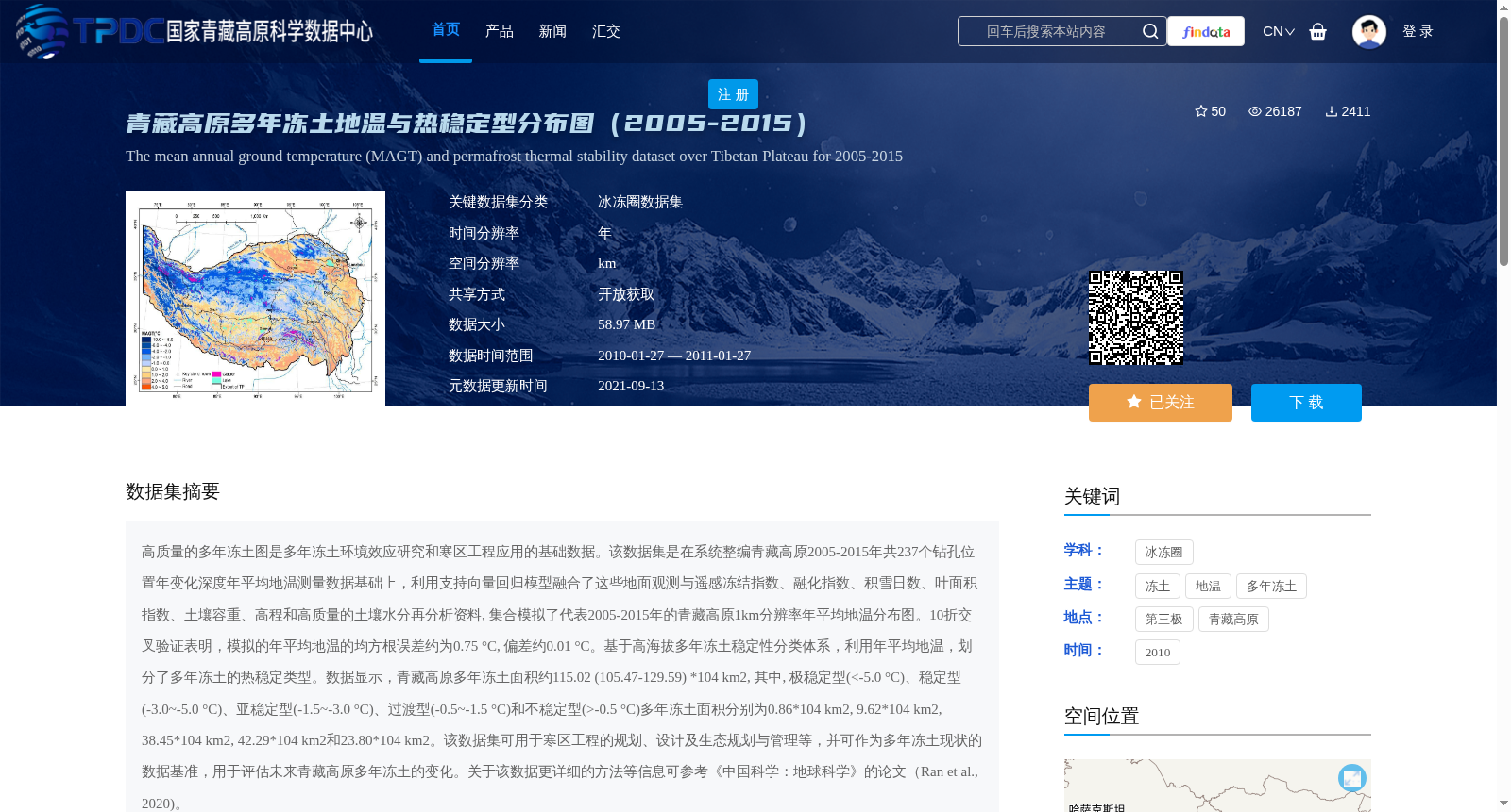
高质量的多年冻土图是多年冻土环境效应研究和寒区工程应用的基础数据。该数据集是在系统整编青藏高原2005-2015年共237个钻孔位置年变化深度年平均地温测量数据基础上,利用支持向量回归模型融合了这些地面观测与遥感冻结指数、融化指数、积雪日数、叶面积指数、土壤容重、高程和高质量的土壤水分再分析资料, 集合模拟了代表2005-2015年的青藏高原1km分辨率年平均地温分布图。10折交叉验证表明,模拟的年平均地温的均方根误差约为0.75 °C, 偏差约0.01 °C。基于高海拔多年冻土稳定性分类体系,利用年平均地温,划分了多年冻土的热稳定类型。数据显示,青藏高原多年冻土面积约115.02 (105.47-129.59) *104 km2, 其中, 极稳定型(<-5.0 °C)、稳定型(-3.0~-5.0 °C)、亚稳定型(-1.5~-3.0 °C)、过渡型(-0.5~-1.5 °C)和不稳定型(>-0.5 °C)多年冻土面积分别为0.86*104 km2, 9.62*104 km2, 38.45*104 km2, 42.29*104 km2和23.80*104 km2。该数据集可用于寒区工程的规划、设计及生态规划与管理等,并可作为多年冻土现状的数据基准,用于评估未来青藏高原多年冻土的变化。关于该数据更详细的方法等信息可参考《中国科学:地球科学》的论文(Ran et al., 2020)。
High-quality permafrost maps serve as fundamental data for studies on environmental impacts of permafrost and cold-region engineering applications. This dataset is constructed based on the systematic compilation of annual average ground temperature measurements at the annual active layer thickness for 237 borehole locations across the Qinghai-Tibet Plateau during 2005–2015. Using a support vector regression model, it fuses these in-situ observational data with remote sensing-derived freezing degree days, thawing degree days, snow cover days, leaf area index, soil bulk density, elevation, and high-quality soil moisture reanalysis datasets, to collectively simulate the 1 km-resolution annual average ground temperature distribution map of the Qinghai-Tibet Plateau for the period 2005–2015. 10-fold cross-validation results show that the simulated annual average ground temperature has a root mean square error (RMSE) of approximately 0.75 °C and a bias of about 0.01 °C. Based on the high-altitude permafrost stability classification system, the thermal stability categories of permafrost are classified using the simulated annual average ground temperature. The dataset indicates that the total permafrost area on the Qinghai-Tibet Plateau is approximately 115.02 (105.47–129.59) × 10^4 km². Specifically, the areas of extremely stable (<-5.0 °C), stable (-3.0 to -5.0 °C), sub-stable (-1.5 to -3.0 °C), transitional (-0.5 to -1.5 °C), and unstable (> -0.5 °C) permafrost are 0.86 × 10^4 km², 9.62 × 10^4 km², 38.45 × 10^4 km², 42.29 × 10^4 km², and 23.80 × 10^4 km², respectively. This dataset can be applied to the planning, design, and ecological planning and management of cold-region engineering, and can act as a data benchmark for the current status of permafrost to evaluate future changes in permafrost on the Qinghai-Tibet Plateau. For more detailed information on the dataset's methodology, please refer to the paper published in *Science China: Earth Sciences* (Ran et al., 2020).