Multi-View-UAV-Dataset
收藏资源简介:
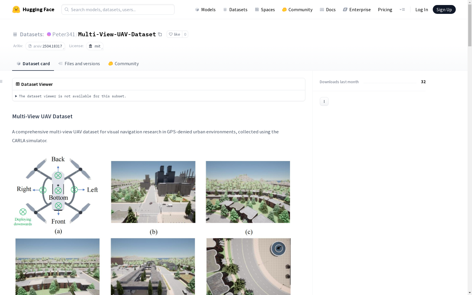
Multi-View UAV Dataset是一个用于无人机视觉导航研究的综合数据集,适用于没有GPS信号的城市环境。该数据集包含了来自无人机上五个不同角度的视觉数据,包括RGB图像、语义分割和深度图,以及精确的位置和旋转角度标签。数据集在不同的城市地图中收集了大量的多视角帧,以支持无人机定位、多视角特征提取与融合、无人机边缘协作等研究。
Multi-View UAV Dataset is a comprehensive dataset dedicated to research on unmanned aerial vehicle (UAV) visual navigation in GPS-denied urban environments. This dataset encompasses visual data collected from five distinct perspectives mounted on the UAV, including RGB images, semantic segmentation masks, depth maps, as well as accurate position and rotation angle annotations. A large number of multi-view frames have been gathered across various urban maps to support research areas such as UAV localization, multi-view feature extraction and fusion, UAV edge collaboration, and other related studies.
Multi-View UAV Dataset 概述
数据集简介
- 用途:支持GPS信号缺失环境下无人机视觉导航研究
- 来源:使用CARLA模拟器采集的多视角无人机数据
- 环境:多样化城市景观模拟环境
关键特性
- 多视角:5个摄像头(前、后、左、右、下)提供全景视觉信息
- 数据类型:
- RGB图像
- 语义分割图
- 深度图
- 标注精度:每帧包含精确的位置坐标和旋转角度
- 环境多样性:8种不同风格的城市地图
- 数据规模:357,690帧多视角数据
数据结构
Multi-View-UAV-Dataset/town{XX}_YYYYMMDD_HHMMSS/ ├── calibration/ # 相机校准参数 ├── depth/ # 深度图数据 ├── metadata/ # 无人机位置、旋转角度和时间戳 ├── rgb/ # RGB图像 └── semantic/ # 语义分割图像
数据格式详情
- 图像数据:
- RGB图像:400×300像素,PNG格式
- 语义分割:PNG格式
- 深度图:
- PNG格式(可视化)
- NumPy格式(精确数值)
- 元数据:
- 无人机位置坐标(x, y, z)
- 旋转角度(roll, pitch, yaw)
- 时间戳信息
- 相机校准:包含所有五个相机的内外参数
采集方法
- 模拟器:CARLA城市驾驶模拟器
- 飞行模式:恒定高度沿道路航点飞行
- 硬件:4×RTX 5000 Ada GPU
- 环境:8个城市地图(Town01-Town07, Town10HD)
研究应用
- GPS缺失环境下的无人机视觉定位
- 多视角特征提取与融合
- 无人机-边缘协作通信
- 任务导向的信息瓶颈方法
- 空中导航深度学习
引用
bibtex @misc{fang2025taskorientedcommunicationsvisualnavigation, title={Task-Oriented Communications for Visual Navigation with Edge-Aerial Collaboration in Low Altitude Economy}, author={Zhengru Fang and Zhenghao Liu and Jingjing Wang and Senkang Hu and Yu Guo and Yiqin Deng and Yuguang Fang}, year={2025}, eprint={2504.18317}, archivePrefix={arXiv}, primaryClass={cs.CV}, url={https://arxiv.org/abs/2504.18317}, }
许可
- 许可证:MIT License
联系方式
- 邮箱:zhefang4-c [AT] my [DOT] cityu [DOT] edu [DOT] hk
- GitHub:https://github.com/fangzr/TOC-Edge-Aerial