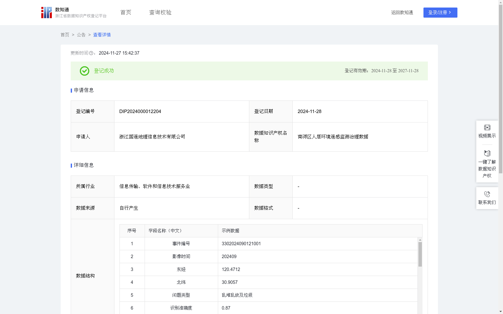
南浔区人居环境遥感监测治理数据
收藏资源简介:
用于监测南浔区人居环境的治理,持续追踪南浔区人居环境问题点位的派发、审核、办结等状态。在识别问题点位坐标并匹配至村镇的基础上,实现地面垃圾存放、建筑材料堆积等不合理不规范现象的长期治理与监管。强化对人居环境遥感监测中问题点位的处置、审批、办结,以及人居环境问题的统计分析与上级督考。系统实时更新问题点位工单派发后的状态、流程与进展,提供问题整改追踪、处置前后对比方式,使问题处置更加快速有效,便于管理人员轻松掌握每项事件的状态与进展,推进问题点位处置流程。同时,基于人居环境治理数据,南浔区人居环境遥感监测治理平台提供问题点位的导航服务,使管理人员以最短距离路径到达问题点位。通过将人居环境遥感监测治理数据归集于人居环境遥感监测治理平台,实现网上便捷服务,极大的提高了问题处置效率与派发、审核等流程的速度,使人居环境治理高效客观。同时提供治理数据统计分析可视化服务,为上级监管提供数据支撑,为考核提供客观依据。促进管理高效运转,形成管理闭环,推进南浔区人居环境治理建设。基于2024年9月遥感影像识别出的人居环境问题点位与村镇匹配结果,将要素分配给相应的镇街和村社区,归集整理点位坐标、识别结果、村镇行政区划等数据,并且可视化点位在空间上的分布情况。系统实时更新点位的状态,包括派发状态、处置状态、审批状态、办结状态,将需要处理的点位信息推送给当前区域的工作人员。工作人员处理完成将成果提交至系统,点位状态发生改变,事件进入下一步骤直至办结。在此基础上,对镇街、村社区的点位进行时间累加、状态标记、类型标记,从而得到人居环境问题点位的数量统计、面积统计、区域分布等数据。每个人居环境问题点位可以独立进行目标定位与追踪,通过与当前位置进行路径规划运算,得出到达点位的最佳路径,实现点位导航。
This dataset is used to monitor the governance of human settlements environment in Nanxun District, and continuously track the statuses such as distribution, review and closure of problem locations of human settlements environment in Nanxun District. Based on identifying the coordinates of problem locations and matching them to villages and towns, long-term governance and supervision of irrational and non-standard phenomena such as ground waste accumulation and building material stacking are realized. The system strengthens the disposal, approval and closure of problem locations in remote sensing monitoring of human settlements environment, as well as the statistical analysis of human settlements environment problems and the supervision and assessment from higher-level authorities. It updates the status, workflow and progress of work orders for problem locations in real time after distribution, provides methods for problem rectification tracking and pre- and post-disposal comparison, making problem disposal faster and more effective, allowing managers to easily grasp the status and progress of each incident and promoting the disposal process of problem locations. Meanwhile, based on human settlements environment governance data, the Nanxun District Human Settlements Environment Remote Sensing Monitoring and Governance Platform provides navigation services for problem locations, enabling managers to reach the locations via the shortest-distance route. By centralizing the governance data of human settlements environment remote sensing monitoring onto the platform, online convenient services are realized, which greatly improves the efficiency of problem disposal and the speed of processes such as work order distribution and review, making the governance of human settlements environment efficient and objective. It also provides visualization services for statistical analysis of governance data, providing data support for higher-level supervision and objective basis for assessment. This promotes the efficient operation of management, forms a closed-loop management mechanism, and advances the construction of human settlements environment governance in Nanxun District. Based on the matching results between human settlements environment problem locations identified from September 2024 remote sensing images and villages and towns, elements are allocated to corresponding towns, sub-districts, villages and communities. Data such as location coordinates, identification results and village-town administrative divisions are collected and sorted out, and the spatial distribution of the locations is visualized. The system updates the statuses of the locations in real time, including distribution status, disposal status, approval status and closure status, and pushes the information of locations requiring processing to staff in the current area. After staff complete the processing, they submit the results to the system, the status of the location changes, and the incident proceeds to the next step until closure. On this basis, time-based accumulation, status tagging and type tagging are performed for the locations of towns, sub-districts, villages and communities, thus obtaining data such as quantity statistics, area statistics and regional distribution of human settlements environment problem locations. Each human settlements environment problem location can independently perform target positioning and tracking, and by conducting route planning calculation with the current location, the optimal route to the location is obtained, realizing location navigation.