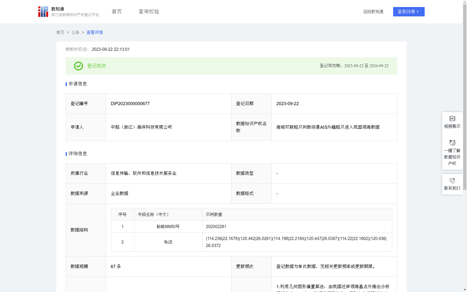
海域可疑船只判断场景AIS外籍船只进入我国领海数据
收藏资源简介:
该数据为二次加工数据,主要是以2019年10月31日-2022年4月30日期间全球AIS数据为基础,运用轨迹碰撞算法,对船舶轨迹进行压缩和区域分析,提取出具有进入我国近岸领海行为并疑似海上作业逗留的船只。数据可用于海域态势分析展示、可疑船只判断等场景。1.利用几何图形偏置算法,由我国近岸领海基点外推出分析区域轮廓。2.对AIS数据进行网格化,提取出分析区域轮廓内的数据。3.对曾在所述时间段内出现在分析区域内的外国国籍AIS目标进行轨迹压缩、存储。具体做法是:搜索所有曾经出现在分析区域内的AIS目标;将AIS目标船舶MMSI号与档案库进行匹配,分析实际国籍为非中国国籍的目标;查找出该AIS目标的所有轨迹点,根据DP算法对轨迹形状进行提取,删除不必要的轨迹点。4.基于轨迹的时空特征筛选出疑似海上作业逗留的目标。具体做法是:对压缩后的轨迹按停留点进行分段,将两个停留点之间的轨迹段输入到支持向量机中进行分类,分类得到轨迹段属于航渡轨迹或是作业轨迹;若某轨迹段属于作业轨迹,则将该目标作为疑似海上作业逗留目标进行存储。
This is a secondarily processed dataset developed based on global Automatic Identification System (AIS) data collected between October 31, 2019 and April 30, 2022. Using the trajectory collision algorithm, this dataset compresses and conducts regional analysis on vessel trajectories, and extracts vessels that have entered China's nearshore territorial waters and are suspected of offshore operation and stay. This dataset can be applied in scenarios such as maritime situation analysis and display, suspicious vessel identification, etc. 1. Adopt the geometric offset algorithm to extrapolate the outline of the analysis area based on the territorial sea baselines of China’s nearshore waters. 2. Perform grid processing on the global AIS data, and extract the data points within the outline of the aforementioned analysis area. 3. Conduct trajectory compression and storage for foreign-flagged AIS targets that appeared within the analysis area during the aforementioned time period. The specific procedures are as follows: a. Search for all AIS targets that have appeared within the analysis area; b. Match the MMSI numbers of these AIS vessels with the official database to identify targets with actual non-Chinese nationality; c. Retrieve all trajectory points of the identified foreign targets, then extract the trajectory shape using the Douglas-Peucker (DP) algorithm to delete redundant trajectory points. 4. Screen targets suspected of offshore operation and stay based on the spatiotemporal features of the compressed trajectories. The specific implementation steps are: a. Segment the compressed trajectories based on their stopover points; b. Input the trajectory segments between two consecutive stopover points into a Support Vector Machine (SVM) for classification, to determine whether the trajectory segment belongs to a transit trajectory or an operation trajectory; c. If a trajectory segment is classified as an operation trajectory, store the corresponding target as a suspected offshore operation and stay target.